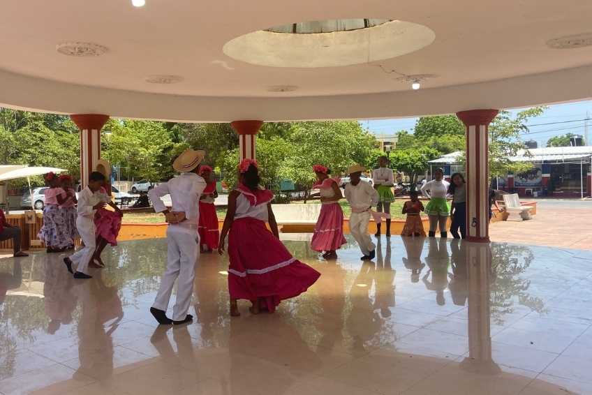
Hoyo de Pelempito Visitors Guide
 Daniel Mode
Daniel Mode
Daniel Mode
 Laura Schulthies
Laura Schulthies
Laura Schulthies
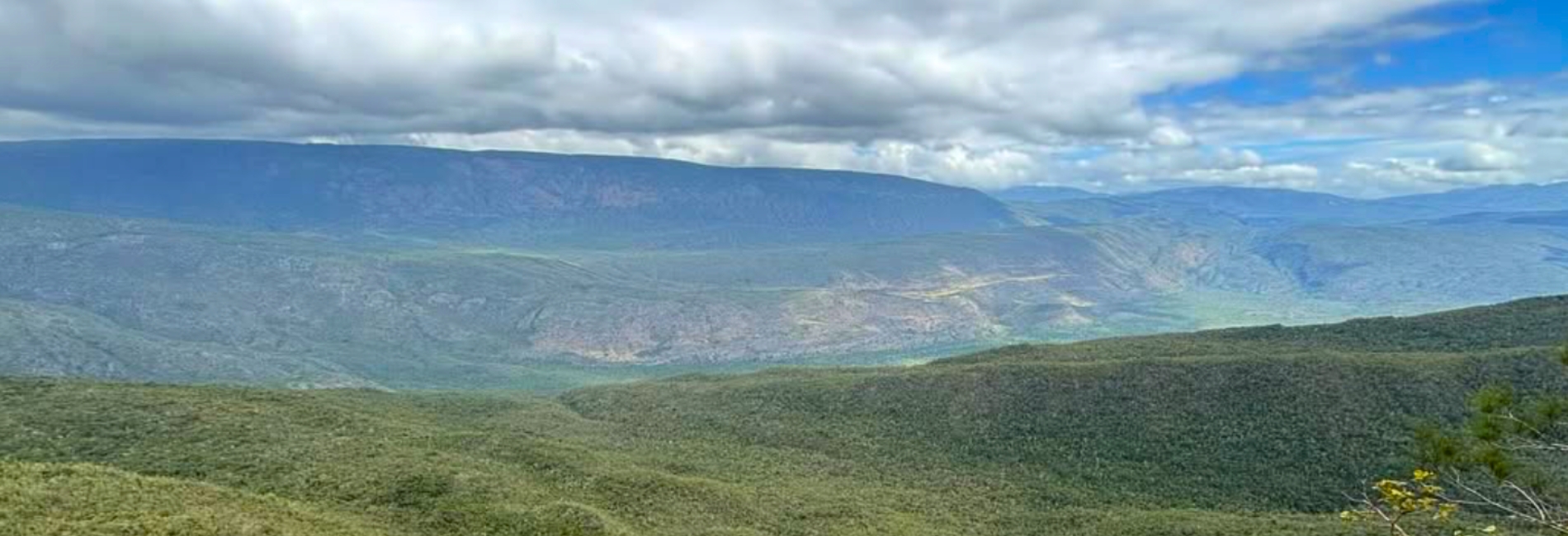
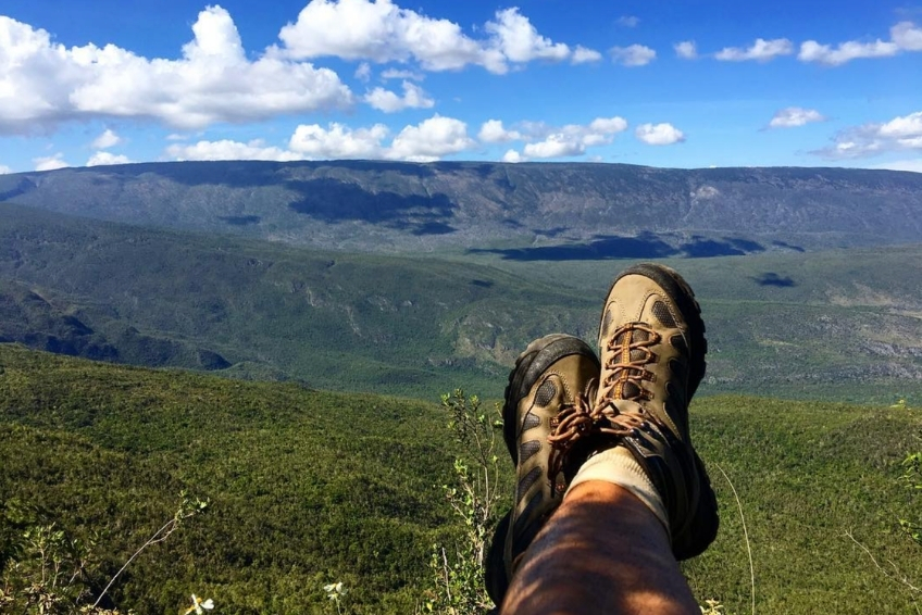
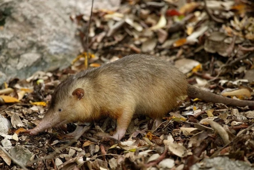
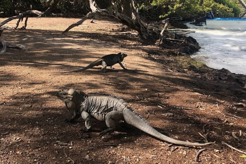
Hoyo de Pelempito is the most dramatic geological sight in the Dominican Republic, a massive depression carved into the Sierra de Bahoruco mountains so deep and wide that clouds gather inside it, and a wooden observation platform at the rim creaks in the wind above a 700-meter drop. It sits inside Sierra de Bahoruco National Park, part of the UNESCO-designated Jaragua-Bahoruco-Enriquillo Biosphere Reserve, and holds the greatest biodiversity of any ecosystem on the island. The preserve is home to over 1,400 plant species, 13 endemic bird species, rhinoceros iguanas, and the critically endangered Hispaniolan Solenodon, a small venomous mammal that has survived since the age of dinosaurs. Yet most visitors to the DR have never heard of it.
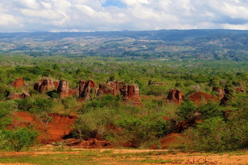
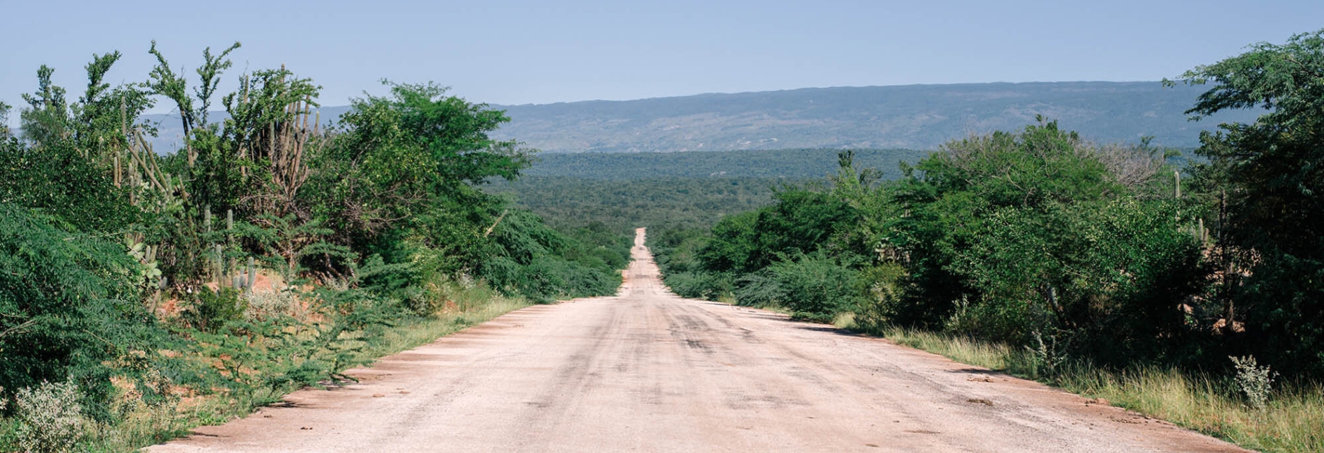
The site’s extreme remoteness keeps the crowds away entirely. You may well arrive to find no one else there. The access road, built by the Alcoa mining company for bauxite mining operations that ran from 1959 to 1983 and extracted an estimated 23 million tons of ore, passes through an otherworldly landscape of red-orange mining remnants and four distinct vegetation zones before delivering you to the cliff edge. A new cruise port at Cabo Rojo now brings ships within 45 minutes of the base of the mountain, and tour operators are starting to run excursions. This guide covers everything you need to plan your visit. Including how to get there, what to expect, wildlife, logistics, and the honest realities of one of the Caribbean’s most spectacular natural wonders.
This article contains affiliate links. If you click on our links, we may earn a small commission at no extra cost to you. This helps us continue to offer free travel guides, but does not influence our recommendations in any way. Thanks for supporting independent travel content.
Contents
Where Is Hoyo de Pelempito?

Hoyo de Pelempito sits inside Sierra de Bahoruco National Park in the remote southwest of the Dominican Republic in Pedernales Province. The observation platform perches at approximately 1,165–1,300 meters above sea level on the southern slope of the Sierra de Bahoruco range.
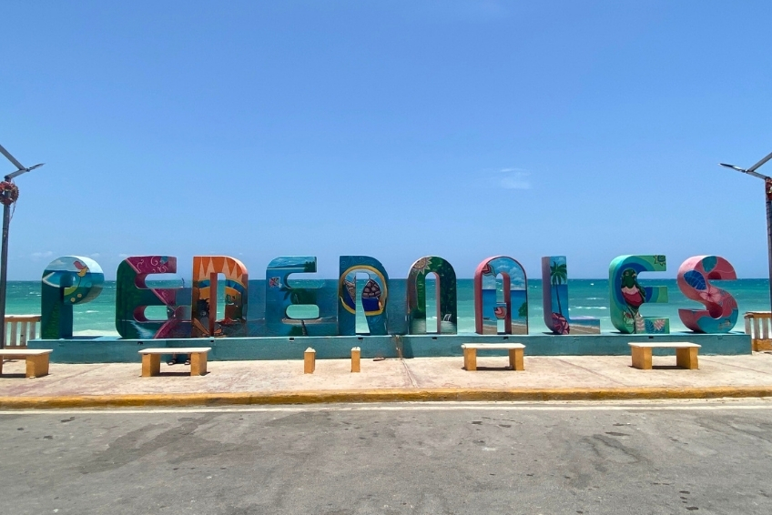
The nearest town is Pedernales Town, about 30 kilometers to the south by road, roughly two hours driving due to the mountainous terrain. Barahona is approximately 155 kilometers east, about three hours away. Santo Domingo is a solid 6-hour drive. The new Cabo Rojo cruise port is about 45 minutes from the base of the mountain road.
How to Get to Hoyo de Pelempito
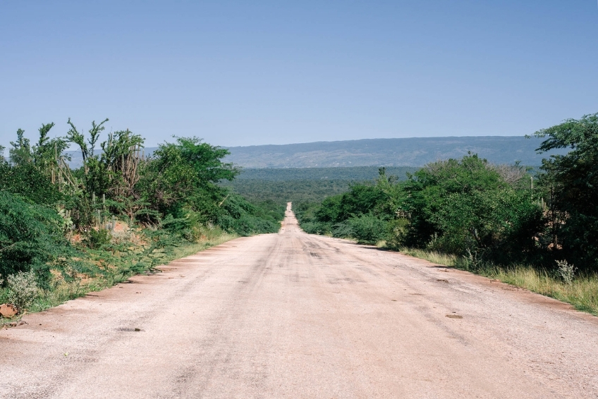
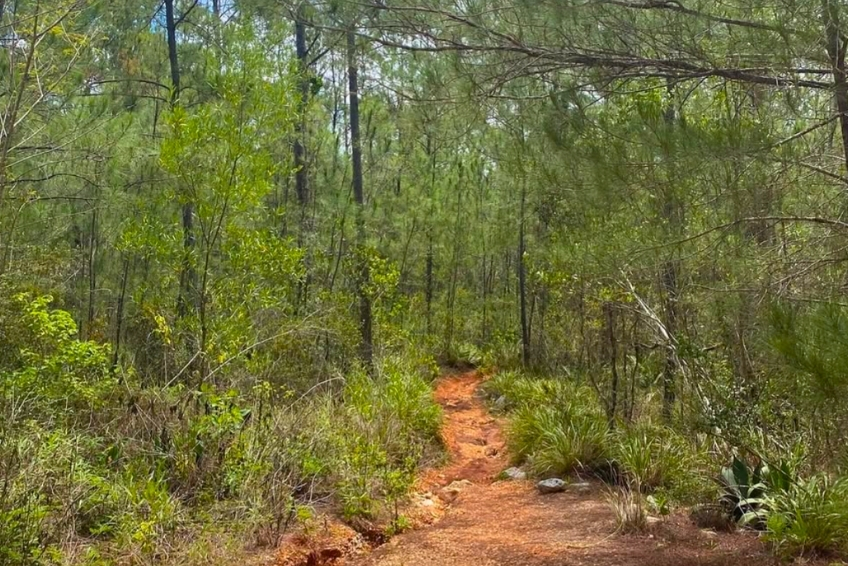
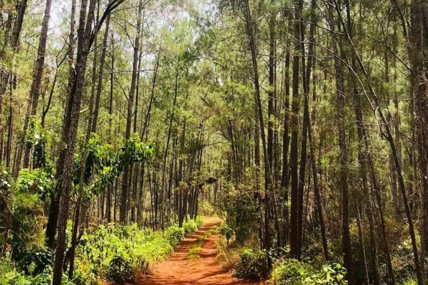
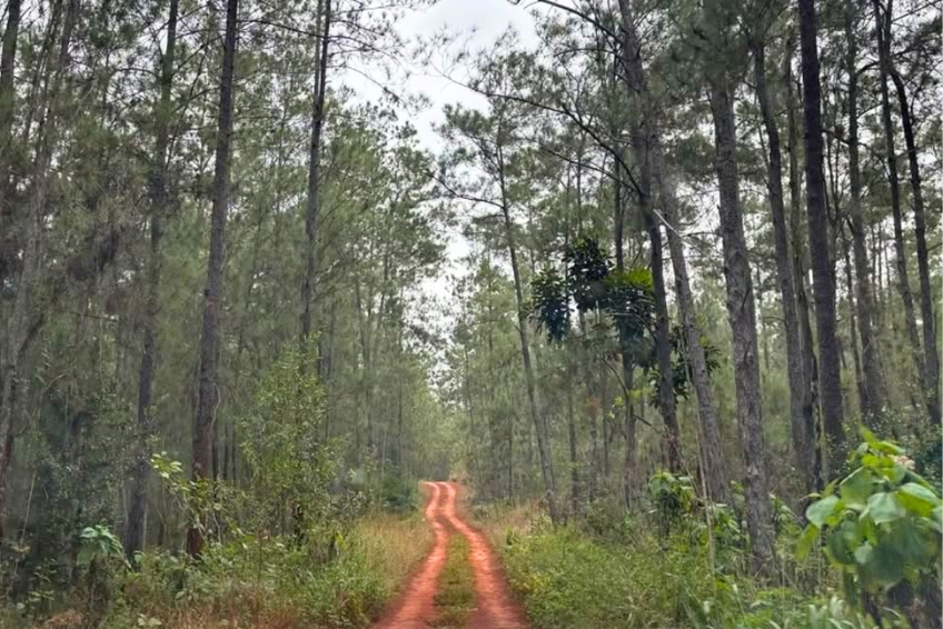
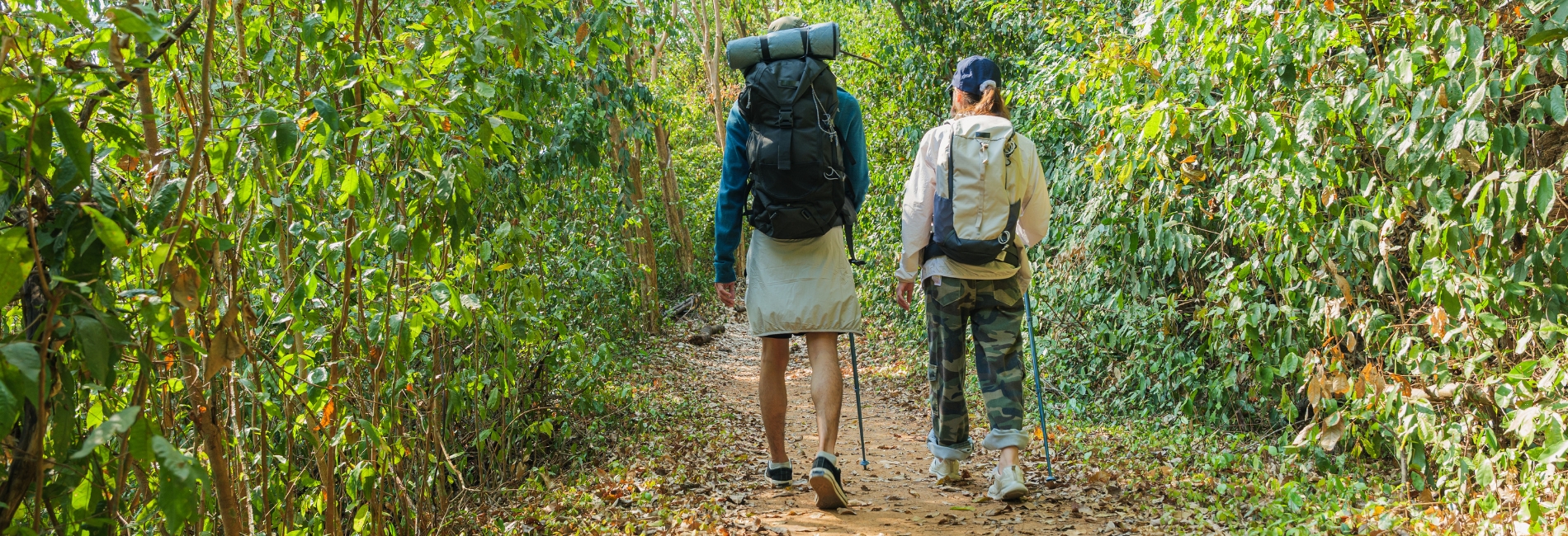
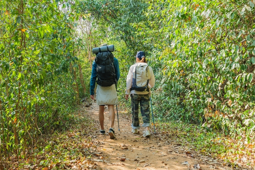
Getting to Hoyo de Pelempito is the most logistically demanding excursion in the Pedernales region, and that’s saying something. The road, built by Alcoa for bauxite mining and paved for most of its length, passes through a remarkable sequence of landscapes: coastal scrub, mining terraces of vivid red earth, broadleaf forest, pine forest, and eventually cloud forest. It ends in a 6–7 kilometer dirt track that requires a 4WD vehicle with good clearance. This is not a trip you improvise. Plan the route, check conditions after any rain, and don’t underestimate how long the final stretch takes.


Driving Yourself
A 4WD vehicle with good ground clearance is mandatory for the last 6–7 kilometers. This is not a suggestion. The dirt track is frequently rutted, washed out after rain, and too rough for sedans or low-clearance SUVs. That final stretch can take nearly an hour even in a capable vehicle. Expect it. Speed limit inside the park is 25 kph.
From Pedernales, take Highway 44 east approximately 12 kilometers until you see the turnoff on the north (left) side of the road, shortly after the junction for Bahia de las Aguilas. Cross a small bridge and turn left onto the road heading north. After approximately 13.5 kilometers, you’ll reach the park ranger station, where you can pay the national park entrance fee. The road continues 16 kilometers beyond the ranger station, initially paved through former Alcoa bauxite mining terrain, before turning into a rutted dirt track for the final 6–7 kilometers to the viewpoint.
From Barahona, take Highway 44 west toward Pedernales for approximately 84 kilometers (about 2.5 hours). Look for the park turnoff on the north (right) side of the highway and follow the route described above.
From Santo Domingo, this is absolutely not a day trip. Plan to overnight in Pedernales or Barahona. The drive from Santo Domingo to the viewpoint and back in a single day is around 12–14 hours of driving alone, before you factor in the slow mountain road.


From the Cabo Rojo Cruise Port
Hoyo de Pelempito is increasingly offered as a cruise shore excursion from the Port of Cabo Rojo, with Norwegian Cruise Line and Royal Caribbean both running dedicated trips. The port is about 45 minutes to the base of the mountain road, with the full journey to the viewpoint taking around 2 hours each way. Norwegian’s “Hidden Natural Wonders” excursion includes a panoramic drive through the bauxite landscape, a 15-minute hike to the observation platform, and interpreter-guided commentary. Pricing starts around $150 per person, with a maximum age of 65. The total duration is approximately 3.5 hours, including transit.
Independent operators, including Larimar EcoTours, also run combined Hoyo de Pelempito + Bahia de las Aguilas full-day packages from the port. See our Tour Options section below for the full breakdown.


Tours
If you would rather skip the logistics entirely, several operators run packages that bundle transport, guides, entrance fees, and in some cases meals into a single price.
Larimar EcoTour is the most established local operator, based in Pedernales. They run group day trips from Pedernales and the Cabo Rojo cruise port, multi-day packages from Santo Domingo, combo tours pairing Hoyo de Pelempito with Bahia de las Aguilas, dedicated birding expeditions into the Sierra de Bahoruco, and private transfers from Santo Domingo or Punta Cana (vehicles hold up to 15 people). Guides are available in English, French, German, Italian, and Spanish.
Cocotours covers private transfers from Santo Domingo, Punta Cana, and the Cabo Rojo cruise port with bilingual drivers. They also run shore excursions for cruise passengers with guaranteed return times.
Ecotour Barahona runs day trips and multi-day packages departing from Barahona, including combination tours covering Hoyo de Pelempito alongside Bahia de las Aguilas and other southwest highlights.


The New Airport (Coming Soon)
The Cabo Rojo International Airport is under construction with a runway capable of handling Boeing 777 aircraft. Originally targeted for late 2025, the opening has been pushed to late 2026. Once operational, it will significantly reduce the logistical barrier for reaching the entire Pedernales region, including Hoyo de Pelempito.

About The Park
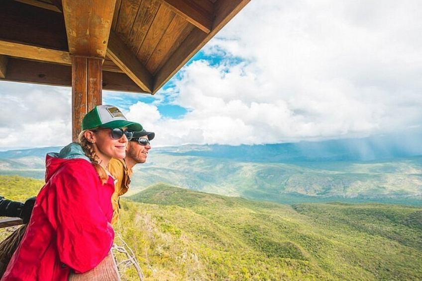
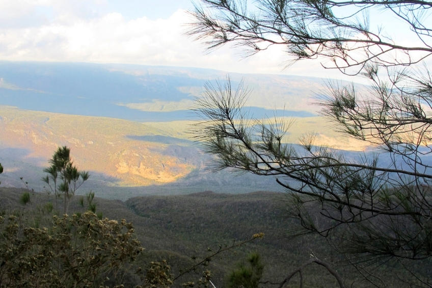
So you’ve bounced up a mountain road for two hours through red-earth bauxite craters and dense pine forest, and you step out onto a wooden platform at the edge of a cliff. The wind hits you first, hard enough to make the structure creak and sway. Then you look down, and out, and you understand why people bother.


A Geological Anomaly in the Caribbean
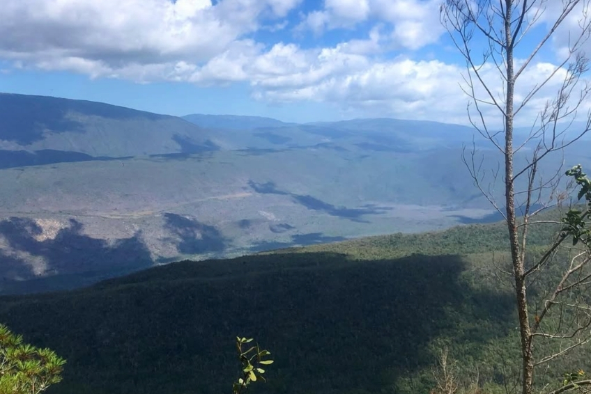
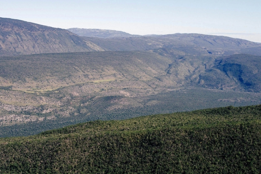
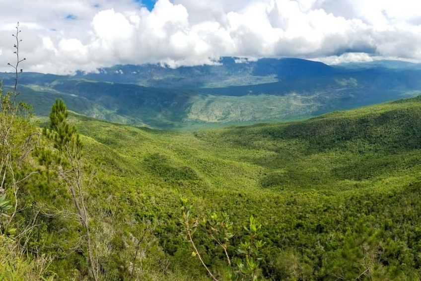
Hoyo de Pelempito is a massive collapsed depression roughly 7 kilometers long, up to 4.8 kilometers wide, and over 700 meters deep from rim to floor. The floor of the depression sits at around 350 meters above sea level, while the surrounding mountain walls rise to 1,800 meters. The shape is roughly triangular, a result of three converging geological faults, including the still-active Pelempito Fault.
How it formed is still debated. The most widely accepted theory holds that the underlying limestone gradually eroded through underground water movement and the slow collapse of an ancient coral reef, while geologically, the depression is understood as a sunken block of crust that dropped between two fault lines, including the still-active Pelempito Fault Zone. A second theory suggests the entire Pedernales Peninsula was once a separate island. A third, less accepted explanation involves a meteorite impact. The fact that no one fully agrees is, oddly, part of the appeal. It’s a mystery!
One thing we know for sure is that the depression was once submerged. Evidence shows the floor was covered by seawater in a previous geological era. The area also sits over the same mineral-rich geology that produces larimar, the rare blue gemstone found only in the Dominican Republic.


The Viewpoint
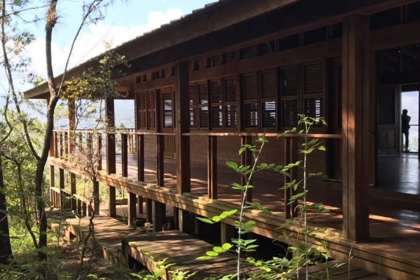
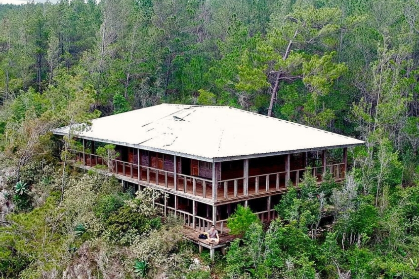
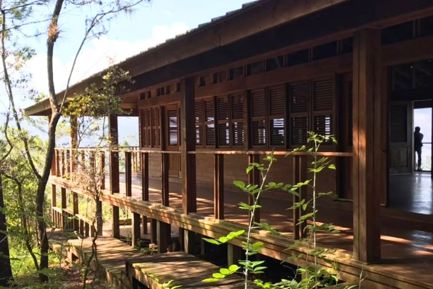
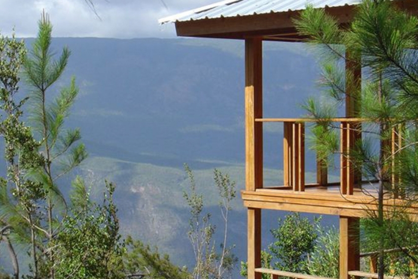
The observation structure is a wooden platform built on a cliff’s edge, designed to blend with the surrounding pine forest. It creaks and moves in the wind, which is constant and strong at this elevation. From the viewing area, you look north and east across an untouched expanse of the national park. It really is breathtaking with red earth visible far below from bauxite deposits, the dark canopy of the forest floor, and the mountain walls rising on all sides. Clouds can gather in the depression and shift across the valley in real time, casting moving shadows on the hillsides. On clear days, you can even see the Caribbean coast in the distance.
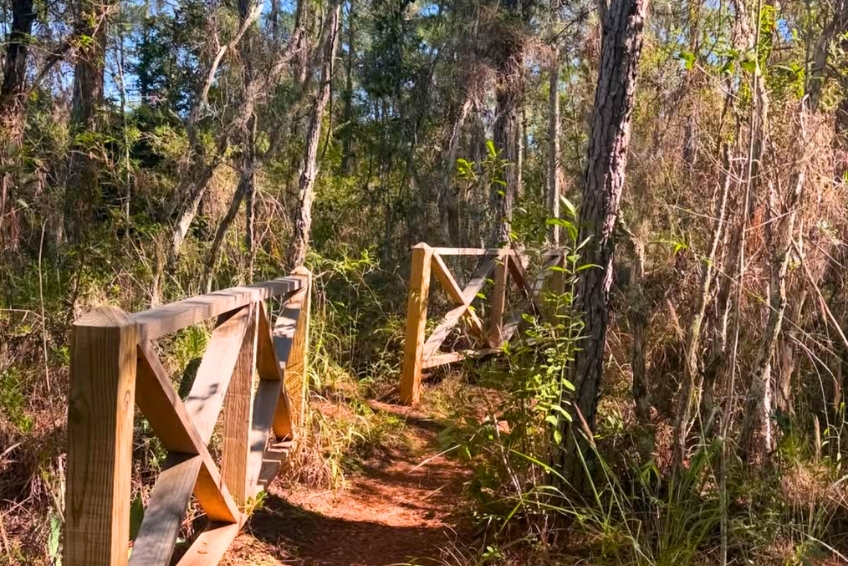
A 15-minute walk from the parking area leads to the platform. The visitor center immediately adjacent has restrooms, a small picnic area, an indoor sitting area, and interpretive displays (in Spanish). Several short nature trails branch from the observation area with plant identification signs.


The Drive Up: As Spectacular as the Destination
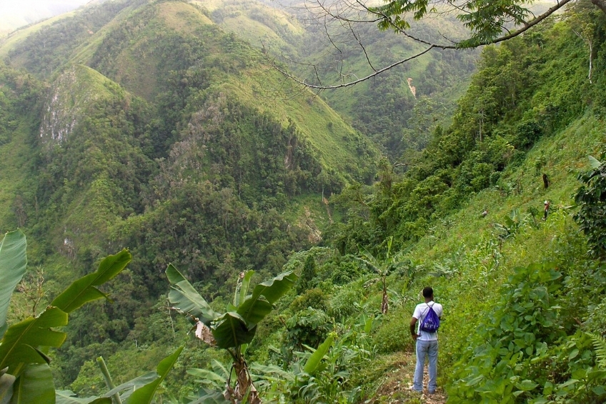
One thing every traveler who makes this trip emphasizes is that the road itself is remarkable. You begin in dry subtropical scrub with cacti and thorny acacia, and within a few kilometers, the vegetation quickly transitions to broadleaf forest. Then, the pine forest takes over, and a landscape of vivid red-orange earth and dramatic columnar formations appears on either side of the road. Higher still, cloud forest closes in. The temperature drops noticeably with every kilometer. The hot coastal wind becomes a cool, pine-scented mountain breeze. A genuine sensory shock. By the time you reach the viewpoint, you’ve passed through ecosystems that don’t normally exist within the same hour’s drive.
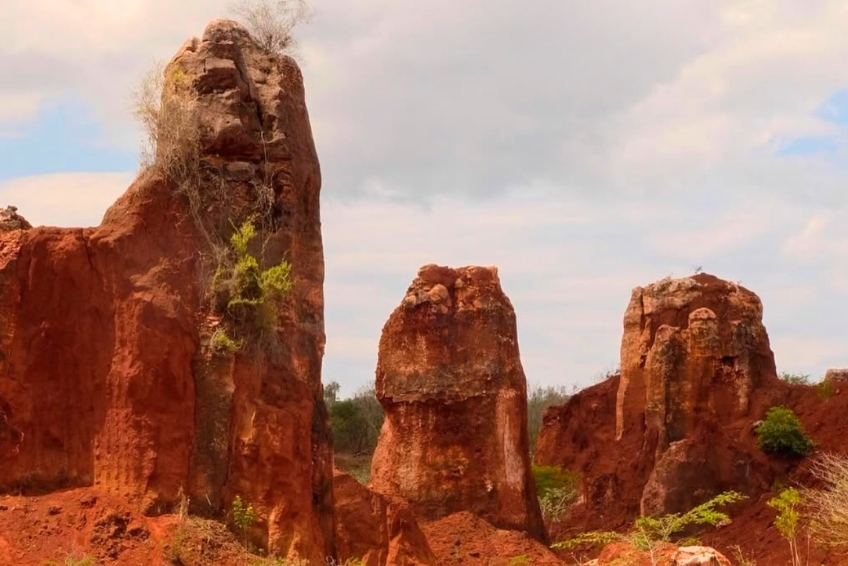
Those striking red-orange pillars and terraced formations are not natural hoodoos or geological spires. They are the remnants of open-pit bauxite mining by the Aluminum Company of America (Alcoa), which began exporting ore in 1959 and extracted an estimated 23 million tons across more than 25 named deposits at the Aceitillar and Las Mercedes sites before operations ceased in 1983. Alcoa also built the paved road that now leads into the park. The red color comes from iron-oxide-rich bauxite ore that saturates the soil. You can stop and photograph them from the roadside, but there are no formal trails through them. This is why some guides call the road “the Grand Canyon of the Caribbean,” a nickname that technically refers to the mining landscape rather than the depression itself, though both are spectacular in their own way.


Biodiversity and Ecology
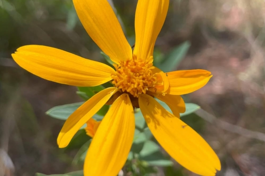
Sierra de Bahoruco National Park covers approximately 1,126 km² and is recognized as the most biodiverse ecosystem on Hispaniola. The park harbors over 1,400 plant species, among the richest orchid diversity in the Caribbean, and 30 of the island’s 32 endemic bird species. Critically endangered mammals, threatened reptiles, and ancient plants found nowhere else on Earth share the same valley.
Despite these protections, the park faces real pressure. Invasive species, illegal clearing, and increased visitor traffic as the cruise port develops. The window to experience it in its current state is narrowing. The park was created by Presidential Decree in 1983 and forms part of the Jaragua-Bahoruco-Enriquillo Biosphere Reserve, designated by UNESCO in 2002.


Infrastructure and Safety
Beyond the visitor center’s basic restrooms and picnic area, there are no facilities at Hoyo de Pelempito. No restaurants, no snack vendors, no cell service. Bring everything you need. The wooden observation platform is safe but does move in the wind, and the cliff edge has no fencing in places. Keep children close. The biggest safety concern is the road itself. If your vehicle breaks down on the final dirt track, you are hours of walking from the nearest house, with no phone signal.
The nearest medical facility is in Pedernales, approximately 30 kilometers south. Barahona has more comprehensive facilities at around 155 kilometers. Travel medical evacuation insurance is strongly recommended for any trip to this remote area. Cash is essential. No ATMs exist anywhere near the site. Bring Dominican pesos from Barahona, Pedernales or Santo Domingo.
Things To Do At Hoyo de Pelempito
The viewpoint is the headline, but the site rewards more than a quick look. Here’s what you can actually do, and what wildlife you’re likely to encounter.
click to see more images
1. The Mirador (Observation Platform)
This is what everyone comes for. The platform puts you at the rim of a 700-meter drop with nothing between you and an unobstructed panorama of the entire depression. Spend time here. Watch the clouds move through the valley. Let your eyes adjust to the scale. Photographs can barely capture what you’re seeing. The human brain processes scale and depth in ways a camera sensor cannot. Stand at the railing for a while before you reach for your phone.
The best light is early morning or late afternoon, when orange and pink hues wash across the mountain walls, and the shadows in the depression deepen. Cloudier days often produce more dramatic atmosphere than perfectly clear ones, as mist and cloud formations gather in the valley below.
click to see more images
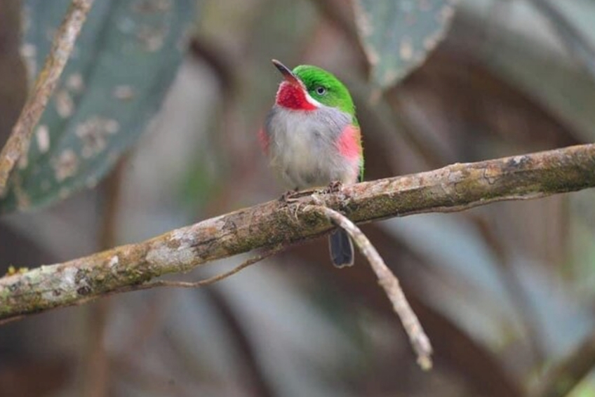
2. Birding
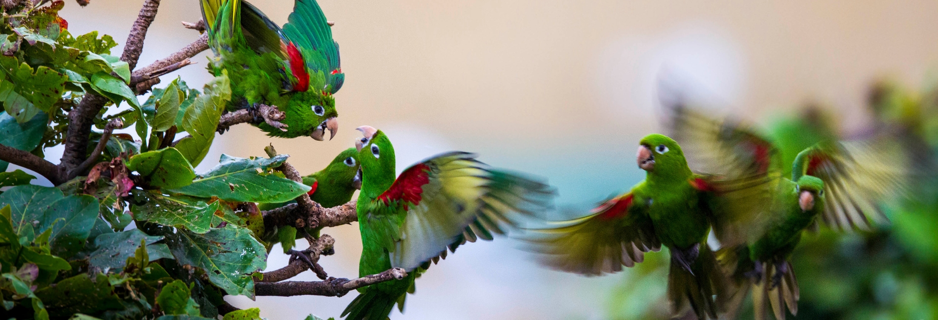
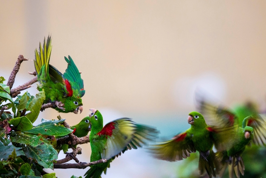
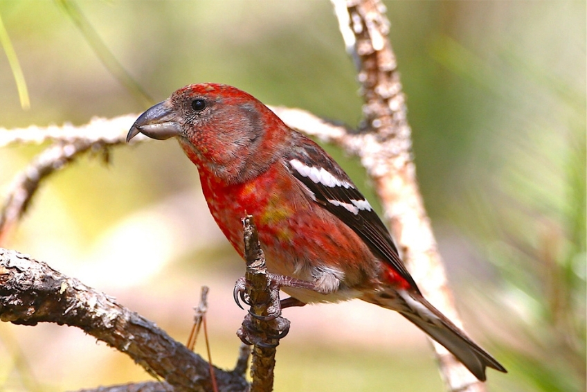
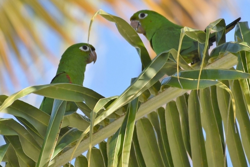
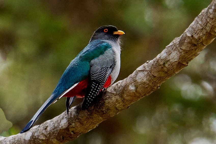
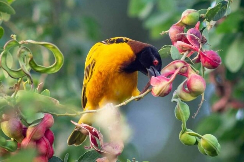
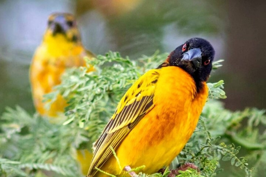
This is one of the premier birding locations in the entire Caribbean, and serious birders have been making dedicated trips here for decades. The Hispaniolan Parakeet (Psittacara chloropterus) and Hispaniolan Parrot (Amazona ventralis) are both confirmed residents and are particularly active in the late afternoon. The Hispaniolan Trogon (Barrancolí) is reliably seen. Other species regularly recorded include the White-necked Crow, Bay-breasted Cuckoo, Least Poorwill, Western Chat-tanager, and La Selle Thrush.
The Aceitillar area along the road up to Pelempito is specifically noted by the Caribbean Birding Trail as one of the best spots on the island for Hispaniolan Crossbills, Golden Swallows, and Hispaniolan Emeralds. Serious birding groups routinely treat the Alcoa Road itself as the primary destination, stopping at the inactive open-pit mine areas where Green-tailed Ground Tanagers forage in pine groves and Golden Swallows circle the old pit edges.


click to see more images
3. Wildlife Spotting
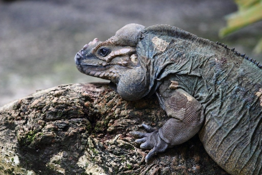
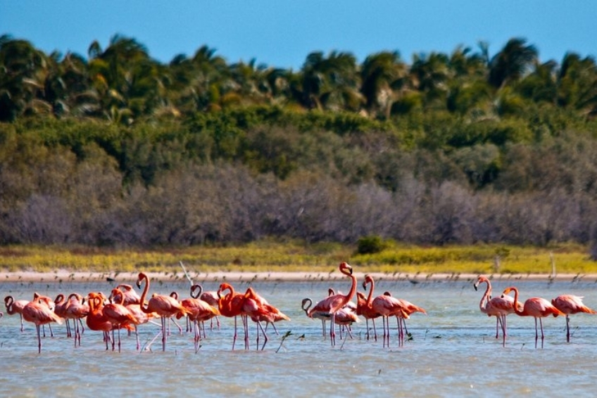
Rhinoceros iguanas are commonly spotted along the road up to the viewpoint and around the parking area. Give them space. Unlike the iguanas at Laguna de Oviedo that are accustomed to visitors, these are genuinely wild animals that happened to wander into your sightline.
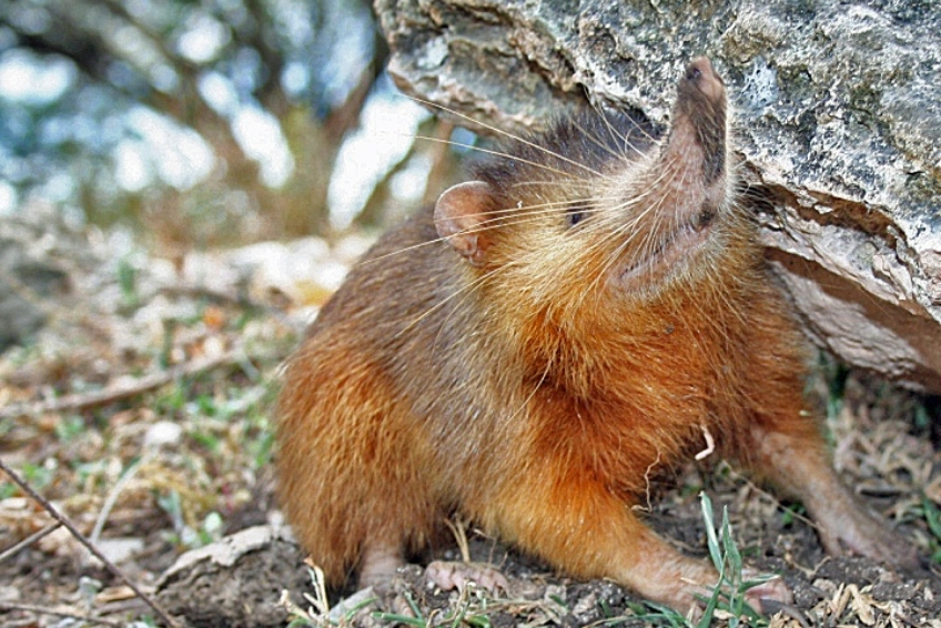
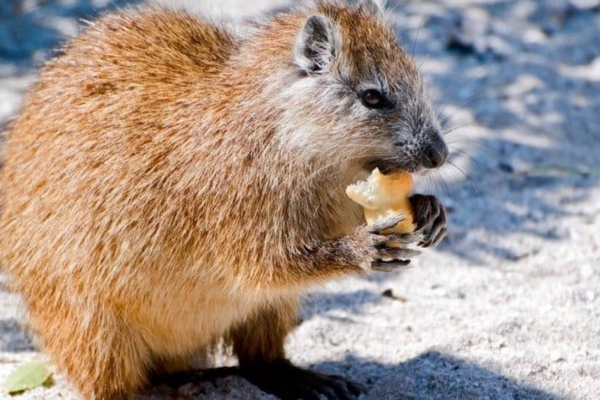
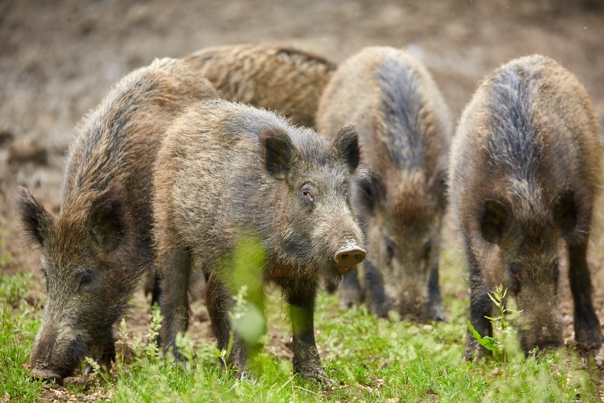
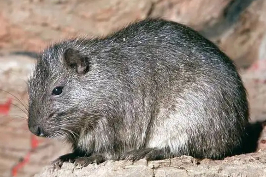
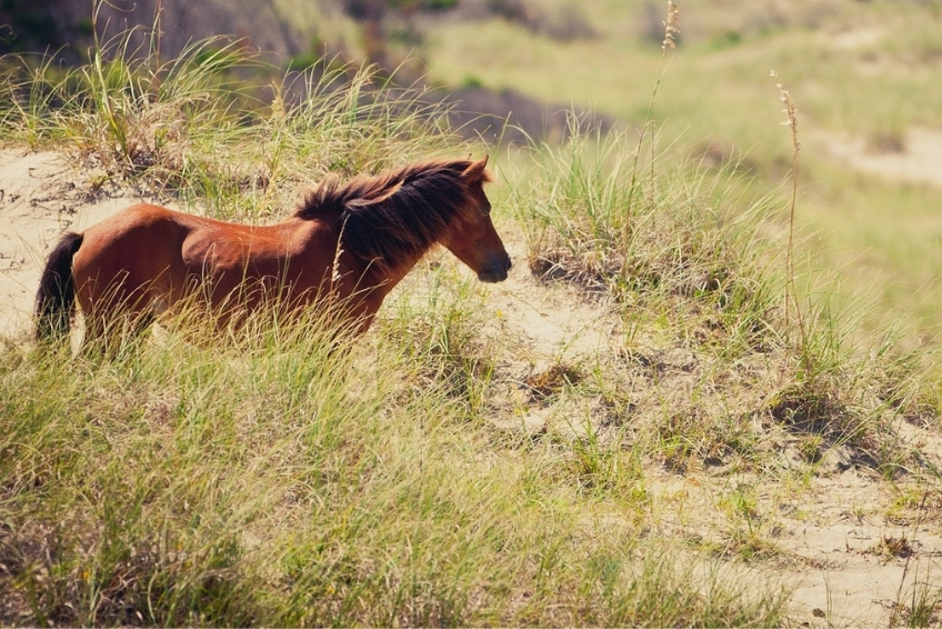
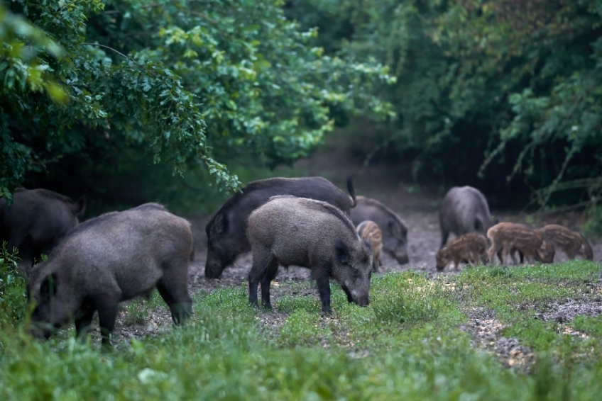
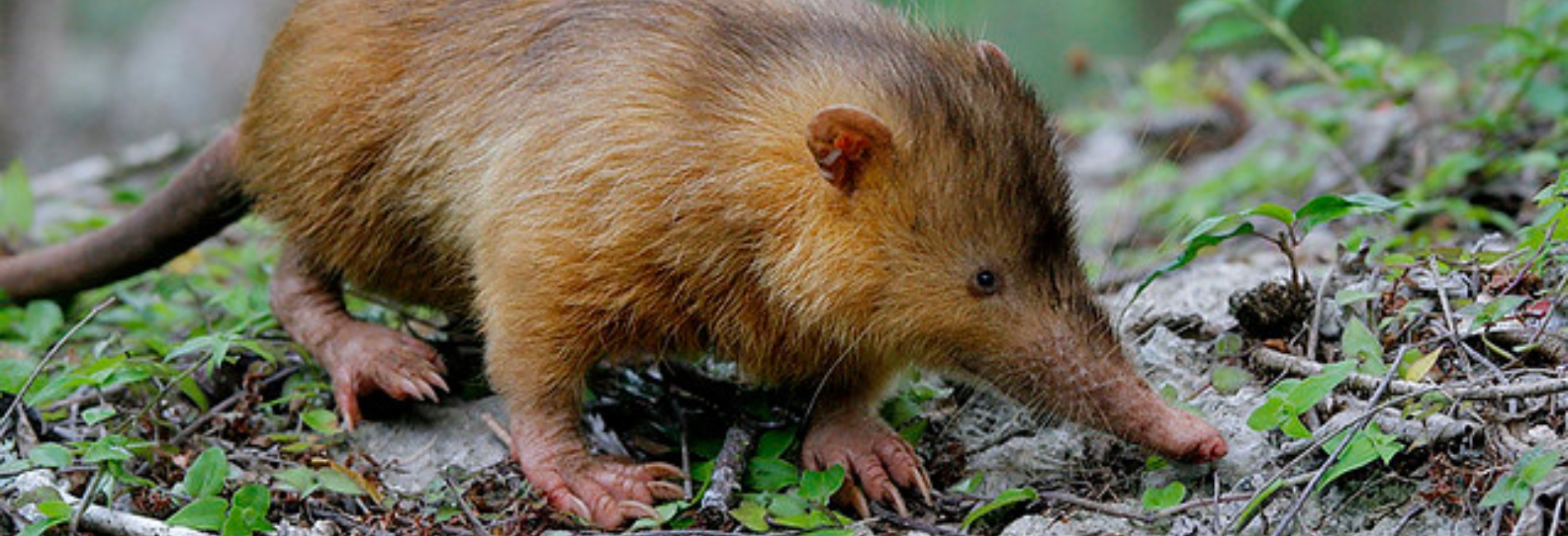
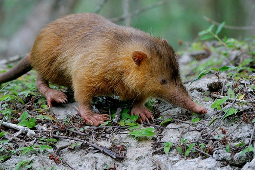
The depression floor is also home to wild horses and feral pigs, giving it a genuinely lost-world atmosphere when viewed from above. The park also shelters the small, shrew-like Hispaniolan Solenodon, one of only two solenodon species remaining on Earth and one of the very few venomous mammals alive today. A “living fossil” that coexisted with dinosaurs and survived the mass extinction, the solenodon is nocturnal and almost never seen by visitors, but knowing it’s down there adds something to the experience. The endangered Hispaniolan Hutia, similar in size and appearance to a rat, is also present.
click to see more images
4. Nature Trails
Several short trails branch from the viewpoint area along the rim, all free with your park entrance fee and open to self-guided exploration. The paths wind through a dense stand of Hispaniolan pine, with periodic clearings that offer fresh angles down into the depression. Plant identification signs appear at regular intervals along the way, though they are in Spanish only.
The trails reward slow walkers. The pine forest here is not background scenery; it is one of the most ecologically significant habitats in the Caribbean, sheltering species found nowhere else on Earth. Orchids grow from the bark of the trees. The ground cover shifts from pine needles to mosses to bromeliads within a few steps. In the early morning, the trails are cool and bird-active, with the calls of the Hispaniolan Trogon and White-necked Crow carrying through the canopy. Late afternoon brings the parakeets and parrots that roost in the pines near the viewpoint.
None of the trails are strenuous. They are short, mostly flat rim walks rather than serious hikes, and can be completed comfortably in rubber-soled shoes, though proper hiking footwear is always better given the exposed roots and occasional rocky sections. Plan for 30–45 minutes if you want to explore them properly.
click to see more images
Nearby Attractions Worth Combining
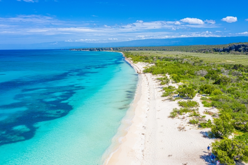
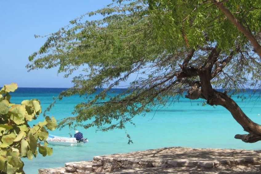
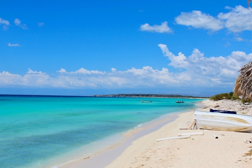
Bahia de las Aguilas is the obvious pairing. The beach is about 45 minutes from the base of the mountain road by car, and many operators run combined full-day excursions covering both. Start early at Pelempito when the light is best and the temperature is coolest, then head down to the coast for the beach in the afternoon.
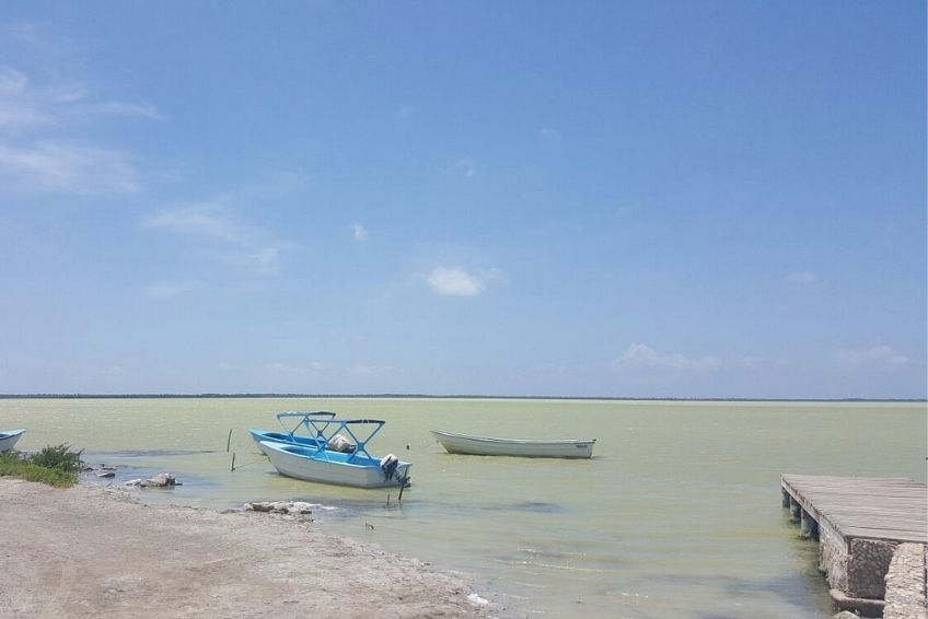
Laguna de Oviedo is about 55 kilometers east of Pedernales on Highway 44, around 1 hour from the base of the mountain road. Adding all three (Pelempito + Bahia + Laguna) in a single day is aggressive but doable with an early start and a reliable 4WD. Two days based in Pedernales is far more comfortable.
Sierra de Bahoruco National Park extends well beyond Pelempito and contains some of the most important cloud forest birding habitat on Hispaniola. The Cachote area in the eastern Bahoruco is accessible from Barahona and is considered a separate and complementary birding destination. Check our complete Pedernales Visitors Guide for the full breakdown of all nearby attractions.
Where to Eat near Hoyo de Pelempito
Let’s be direct. There is no food at Hoyo de Pelempito. The visitor center has a dining room on paper, but don’t count on it being operational. Bring snacks and water. For proper meals, the options are all in Pedernales, about 30 kilometers south and two hours of driving away.


In Pedernales Town
Bocanye, Grill & Seafood, on Calle Libertad, is a solid Caribbean seafood spot with a varied menu and good portions. It’s one of the better homestyle restaurants in town and worth a visit, especially if you’re staying more than one night.
Restaurante Jalicar on Calle Libertad is our pick for the best value meal in town. Generous family-style plates of pescado frito, lambi al ajillo, and chicken with rice and beans for around RD$1,000 ($17 USD) for the table. No frills, just excellent home-cooked Dominican seafood at prices that feel like a steal.
El Navio Bar and Seafood sits right on Pedernales Beach with a sustainable-fishing-focused menu of lobster, red snapper, and conch. It’s the best spot in town for a sunset meal with your feet practically in the sand. It can be a little crowded, and it is definitely pricey for Pedernales.
Hotel Pedernales Italia serves homemade Italian-Dominican dinners to guests that are genuinely excellent. If you’re staying there, don’t miss the evening meal.
Meals across the region typically cost RD$300-1,000 ($5-17 USD). Cash only at virtually every establishment. Check out our Pedernales Visitors Guide for a full dining rundown.


Along the Route
Several basic comedores operate in the communities along Highway 44 between Pedernales and the mountain turnoff. These serve rice, beans, fried fish, and plantains for $3–5 USD. They are reliable for a simple fueling stop before the drive up, but they may not always be open early in the morning. If you’re driving from Barahona, the roadside seafood restaurants in Paraiso and Los Patos are worth a stop for fresh fried fish with tostones on the coastal highway portion of the drive.


What to Order
Traditional dishes worth seeking out
- Mofongo (mashed plantains with garlic, often stuffed with seafood)
- Pescado frito (whole fried fish with moro rice and tostones)
- Lambi (conch, prepared various ways)
- Cangrejo con tostones (crab with fried plantains).
For something quick and easy, many street vendors sell empanadas and yaniqueques (fried dough) for pocket change.
Meals across the region typically cost RD$300-1,000 ($5-17 USD). Cash only at virtually every establishment. Check out our Dominican Republic Food Guide for more on what to eat and how to order.
Where to Stay near Hoyo de Pelempito
There are no hotels near Hoyo de Pelempito itself. For a single-day visit, Pedernales is the closest and most practical base, putting you about 2 hours from the viewpoint. For 2+ days exploring the full Pedernales region (Pelempito + Bahia de las Aguilas + Laguna de Oviedo + Sierra de Bahoruco), staying in Pedernales minimizes driving and maximizes time outdoors. Barahona offers better amenities and more hotel options at the cost of significantly more daily driving.
In Pedernales (Recommended)


Hotel Pedernales Italia
Hotel Pedernales Italia (around $37-44/night) is run by Italian couple Gianni and Viviana. This small 8-room guesthouse is the kind of place that makes you feel like a houseguest rather than a customer. The rooms are clean, air-conditioned, and comfortable. The homemade Italian-Dominican meals (breakfast included, dinner available) is some of the best food in Pedernales. But what really sets it apart is Gianni’s encyclopedic knowledge of the area and genuine willingness to help guests plan excursions, arrange transport, and navigate the region. He’ll give you more useful information about the surroundings than the Ministry of Tourism. The only caveat is that Gianni speaks Spanish and Italian but has limited English, so brush up on your Spanish or bring a translation app. Book in advance, as eight rooms fill fast. Check Prices here


Hotel Vista de Aguilas Ecolodge
Hotel Vista de Aguilas Ecolodge (around $69-82/night) is the nicest physical property in town with handmade wooden furniture, seashell lamps, a small pool, spa services, and an on-site restaurant with fresh juices. The rooms are air-conditioned with private bathrooms, and the complimentary cooked-to-order breakfast is solid. The staff goes out of their way to help with tour planning and logistics, and the overall feel is a genuine boutique eco-hotel. If you want the most comfortable room in Pedernales and don’t mind paying a bit more, this is the one. Our only nitpick is that dinner options are limited, so plan to eat elsewhere for evening meals if staying for several days. Check Prices here


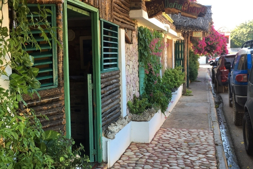
Hostal Dona Chava
Hostal Dona Chava (around $30-45/night) is a wonderful surprise. Don’t let the word “hostal” fool you, this is a proper 21-room guesthouse that’s been family-run for three generations. The lush garden courtyard is one of the most relaxing spaces in Pedernales, filled with plants, comfortable rocking chairs, and a bar where you’ll end up trading stories with other travelers. Rooms have air conditioning, and the staff treats every guest like family. The location is excellent, right near the bus stop and a short walk to everything in town. If you’re on a budget, this is the best value in the region. If you’re not on a budget, it’s still worth considering for the atmosphere alone. Check Prices here


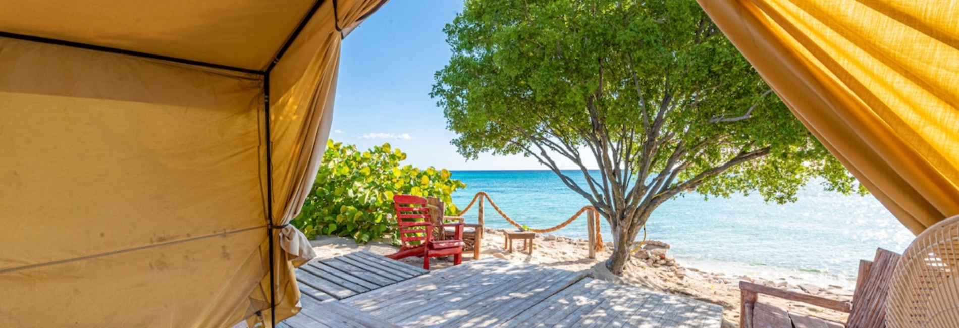
Glamping at Cabo Rojo
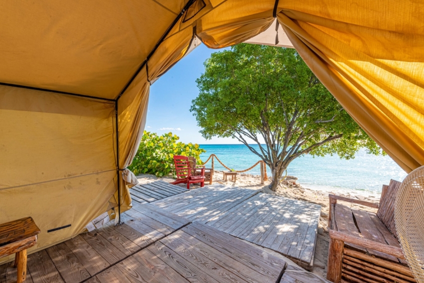
The signature adventure experience for the area is Glamping EcoLodge Cueva de las Aguilas (around $66-195/night depending on tent type, breakfast included), beachfront tents with real beds on a private beach near La Cueva. The location is legitimately stunning as you fall asleep to the sound of waves and wake up steps from the Caribbean. The on-site Rancho Tipico restaurant serves excellent seafood, and they arrange boat tours to Bahia de las Aguilas directly from the property. With 35+ tents, this is by far the most popular accommodation in the region, and it books up fast. That said, keep your expectations calibrated. There’s no air conditioning (fans only), no WiFi and shared bathrooms for most tent types. Heat and mosquitoes can be intense, especially May through October. On busy weekends and cruise ship days, the staff can get overwhelmed, and service slows down. We’ve seen tent zippers that needed repair and a general sense that popularity is outpacing maintenance. It’s glamping, not a resort. That being said, come with the right mindset, and you’ll love it.
In Barahona and Cabo Rojo


In Barahona
Barahona offers a wider range and generally better amenities. Casa Bonita is the luxury standout (hilltop infinity pool, Caribbean Sea views, around $150-250+/night). Mid-range options include Hotel Caribe (around $58/night, breakfast/dinner included) and Hotel El Quemaito (around $121/night, oceanfront). Budget travelers should check out Hotel Loro Tuerto (around $25-30/night) and numerous guesthouses in the area.


What's Coming Soon in Cabo Rojo
The Cabo Rojo mega-resort development will fundamentally change the accommodation landscape. Iberostar Cabo Rojo (588 rooms) is expected to open in early 2027 as the first major all-inclusive resort. La Quinta by Wyndham (110 rooms) was planned for 2025 but its current status is unclear. Secrets Hyatt (507 rooms) and Dreams Hyatt (504 rooms) are targeted for 2027. The long-term plan calls for 12,000 hotel rooms by 2033 from chains including Hilton, Marriott, Karisma, and Sunwing. The Pedernales of 2030 will look nothing like the Pedernales of today.
What to Pack
The mountain environment at Hoyo de Pelempito demands more preparation than most Caribbean excursions. You’re going from sea-level desert heat to mountain temperatures that can drop to 15°C (59°F) on the same day. There are no vendors, no facilities beyond basic restrooms, and no cell service. Forget something important, and you’re stuck without it.
The Essential Packing List
- A jacket or warm layer (Non-negotiable. Temperatures at the viewpoint can be 10 –15°C cooler than at the coast. The wind chill adds to it. Don’t be caught off-guard by this.)
- Sturdy closed-toe hiking shoes or boots (The trails are rocky and the terrain drops steeply near the platform.)
- At least 2 liters of water per person (No vendors anywhere near the site.)
- Snacks (The drive and hike take longer than expected. There’s nothing to buy.)
- Reef-safe/biodegradable sunscreen (SPF 50+) (The high elevation intensifies UV exposure even when it’s cooler.)
- Wide-brimmed hat and polarized sunglasses
- Binoculars (The bird life here is exceptional, and the scale of the depression rewards magnification.)
- Camera with a wide-angle lens (For the panorama) and a telephoto/zoom lens (For birds and wildlife on the road up.)
- Portable battery charger (No cell service and therefore no reception to drain battery, but bring a charger anyway.)
- Paper map or offline GPS route downloaded (Cell service disappears well before you reach the site.)
- Cash in small-denomination Dominican pesos (For the park entrance fee and any roadside stops.)
- DEET-based mosquito repellent (Less critical than at the lagoon, but useful in forested sections.)
- Full tank of gas (Fill up in Pedernales or Barahona before departing. There are no gas stations on the mountain road.)
- Spanish phrasebook or offline translation app (English is rarely spoken outside tour operators.)

Best Time to Visit Hoyo de Pelempito
The Sierra de Bahoruco gets more rainfall than the Pedernales coastal area, which means weather and road conditions matter more here than at the beach. The viewpoint itself is extraordinary year-round, but when you go shapes both what you see and whether you can get there.
Dry Season (December through April)
This is the optimal window. Road conditions are most reliable, temperatures are comfortable rather than frigid at elevation, and birding is at its peak with both resident endemic species active and North American migrants present. February and March are particularly good as the landscape retains some green from earlier rains, bird activity is high, and the combination with Bahia de las Aguilas makes for a spectacular multi-day trip from Pedernales.
Shoulder Season (May-June and November)
These months are also good options. Temperatures push higher at the coast but remain comfortable on the mountain. The landscape is greener and the vegetation transitions on the drive up are more dramatic. Road conditions can be unpredictable after any rainfall, so check before you go. Cruise ship excursions to Pelempito are running by this point in the tourist season.
Rainy Season (July through October)
This tests your commitment. The final dirt section of road can become impassable after heavy rain, turning what should be a two-hour drive into a muddy standoff. Cloud cover is consistent, which can actually produce a spectacular atmosphere at the viewpoint, but it can also completely obscure the view. July and August see both the most rainfall and the most intense heat at sea level. If you go during this window, go early in the morning before afternoon storms build, and have a flexible itinerary. Monitor hurricane forecasts and carry travel insurance with evacuation coverage.
Time of Day
Early morning and late afternoon are the best times with better light, cooler temperatures, and more active wildlife. The dawn chorus of birds on the mountain road is remarkable. Sunset from the viewpoint, when the depression walls catch orange and pink light, and clouds turn gold in the valley below, is one of the most photogenic moments in the Dominican Republic. Avoid midday in summer months, when the heat at sea level and the exposed drive are both punishing.
Hoyo de Pelempito FAQ
Frequently Asked Questions
Do I need a 4WD to visit Hoyo de Pelempito?
Yes, for the final 6–7 kilometers. The main approach road is paved and accessible by any vehicle as far as the ranger station. The last stretch to the viewpoint is a rutted dirt track that requires a 4WD with good ground clearance. This section is impassable in anything less. Do not attempt it in a sedan or a low-clearance SUV. If you don’t have 4WD, book a guided tour with an operator who does.
How much does it cost to visit Hoyo de Pelempito?
The national park entrance fee is collected at the ranger station (bring Dominican pesos, the exact amount varies). Beyond that, the site itself is free to visit once you’re inside. Guided tour pricing varies by operator and season.
How long does the visit take?
Allow a minimum of a half-day from Pedernales, and a full day is more comfortable. The drive up takes around 2 hours each way, including the slow final dirt section. The viewpoint and trails add another 1–1.5 hours. If you’re combining with Bahia de las Aguilas, plan for a full day with an early start, or better yet, two days based in Pedernales.
Is Hoyo de Pelempito accessible from the Cabo Rojo cruise port?
Yes. The port is around 45 minutes from the base of the mountain road. Norwegian and Royal Caribbean both operate dedicated shore excursions. The full round trip, including transit and time at the viewpoint, takes roughly 3.5–4 hours, which fits comfortably within a cruise port day. Book through your ship or through a local operator like Larimar EcoTours or Cocotours. See above for complete details.
Will I see wildlife at Hoyo de Pelempito?
Almost certainly. Rhinoceros iguanas are commonly spotted along the road. The drive through Aceitillar offers high bird activity, especially in the early morning. The Hispaniolan Parakeet and Parrot are regularly seen near the viewpoint in late afternoon. The depression floor holds wild horses and pigs, visible from above. The critically endangered Hispaniolan Solenodon also inhabits the park, though it’s nocturnal and almost never seen by day visitors.
Is there cell service at Hoyo de Pelempito?
No. Cell service disappears well before you reach the viewpoint. Download offline maps before leaving town, carry a paper backup route, and make sure someone knows your itinerary. This is a genuinely remote location.
Is Hoyo de Pelempito safe?
The primary safety concerns are the road conditions (especially after rain), the remote location in case of vehicle breakdown, and the exposed cliff edge at the viewpoint. The platform is safe, but it does move in the wind. There is no cell service, and the nearest medical facility is in Pedernales. Come prepared, drive carefully, and keep children supervised near the platform edge. The nearest hospital in Pedernales is roughly 30 kilometers away. Barahona has more comprehensive facilities at around 155 kilometers.
Can I visit Hoyo de Pelempito and Bahia de las Aguilas on the same day?
Yes, and this combination is highly recommended. Many operators offer it as a single package. Logistically, start with Pelempito in the early morning (better light, cooler temperatures), then descend to the coast for Bahia de las Aguilas in the afternoon. The two sites are about 45 minutes apart by road from the mountain base. Check current pricing with Larimar EcoTours or your cruise line’s shore excursion portal.
Is there a restaurant or food at Hoyo de Pelempito?
No. The visitor center has a sitting/dining room on paper, but don’t rely on it being open. Bring your own food and water. There are no vendors anywhere near the site. Stock up in Pedernales before you go.
What language do guides speak at Hoyo de Pelempito?
Self-guided visits have no language barrier, as the site speaks for itself. Interpretive signage at the visitor center is in Spanish only. For English-speaking guided tours, book through Larimar EcoTours, Cocotours, or a cruise shore excursion, all of which offer bilingual guides.
Can you walk among the red rock formations at Hoyo de Pelempito?
The dramatic red-orange columnar formations widely photographed in connection with Pelempito are not natural hoodoos. They are remnants of Alcoa’s bauxite mining operations from 1959 to 1983, located along the access road at the Aceitillar and Las Mercedes sites. You drive past them and can stop to photograph them from the roadside, but there are no formal trails through the formations. The depression itself is viewed from a rim-top observatory.
Is Hoyo de Pelempito worth the effort?
We think, yes. The road is difficult, and the logistics are real, but the combination of the geological spectacle, the endemic wildlife, the extraordinary vegetation transitions on the drive up, and the almost total solitude when you arrive adds up to something genuinely rare in the Caribbean. If you’re already in the Pedernales region for Bahia de las Aguilas, skipping Pelempito would be a mistake.