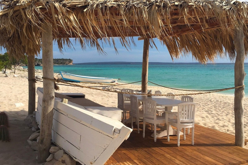
Sierra de Bahoruco National Park Visitors Guide
 Daniel Mode
Daniel Mode
Daniel Mode
 Laura Schulthies
Laura Schulthies
Laura Schulthies
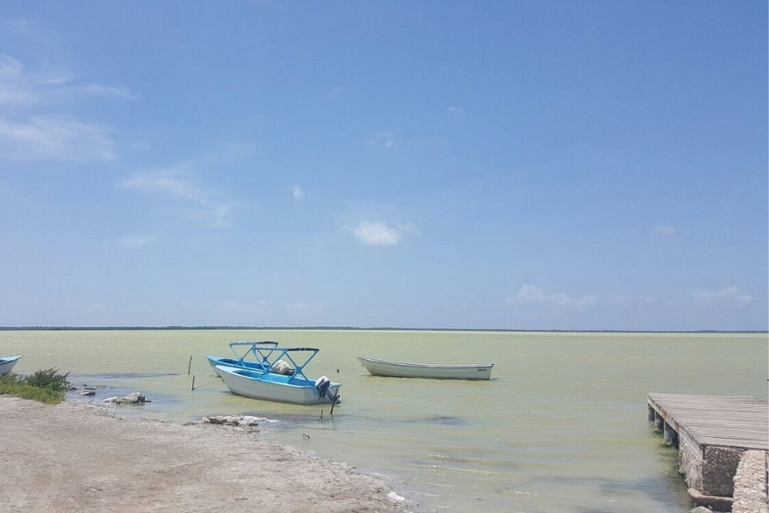
Sierra de Bahoruco National Park is the most biodiverse protected area in the Caribbean. It covers 1,226 square kilometers of rugged mountains in the Dominican Republic’s remote southwest, rising from cactus desert at sea level to cloud forest at 2,367 meters. The park shelters more endemic bird species than any other single site in the West Indies, along with over 1,410 plant species, 166 orchid species, and the island’s only two surviving native land mammals. It is part of the UNESCO-designated Jaragua-Bahoruco-Enriquillo Biosphere Reserve and sits at the heart of the same remote southwest corner that puts Bahia de las Aguilas, Laguna de Oviedo, and Hoyo de Pelempito within a single day’s reach. Yet most visitors to the Dominican Republic have never heard of it.
The park’s extreme remoteness keeps the crowds away entirely. The access roads are rough, the infrastructure is basic, and you may spend an entire morning at one of the premier birding sites on Earth without seeing another visitor. A new cruise port at Cabo Rojo now places the park’s southern entrance within 45 minutes of arriving cruise passengers, and a new international airport under construction near Pedernales will reduce the logistical barrier further once it opens. This guide covers everything you need to plan a visit: Where the park is, how to get there, what to expect from each area, wildlife, tours, accommodation, and the honest realities of one of the Caribbean’s most spectacular wild places.
This article contains affiliate links. If you click on our links, we may earn a small commission at no extra cost to you. This helps us continue to offer free travel guides, but does not influence our recommendations in any way. Thanks for supporting independent travel content.
Contents
Where Is Sierra de Bahoruco National Park?

Sierra de Bahoruco National Park occupies the mountain range of the same name in the Dominican Republic’s Pedernales, Independencia, and Barahona provinces. The park runs roughly 100 kilometers east to west across the southern DR, with the Haitian border at its western edge, where the range continues into Haiti as the Massif de la Selle.
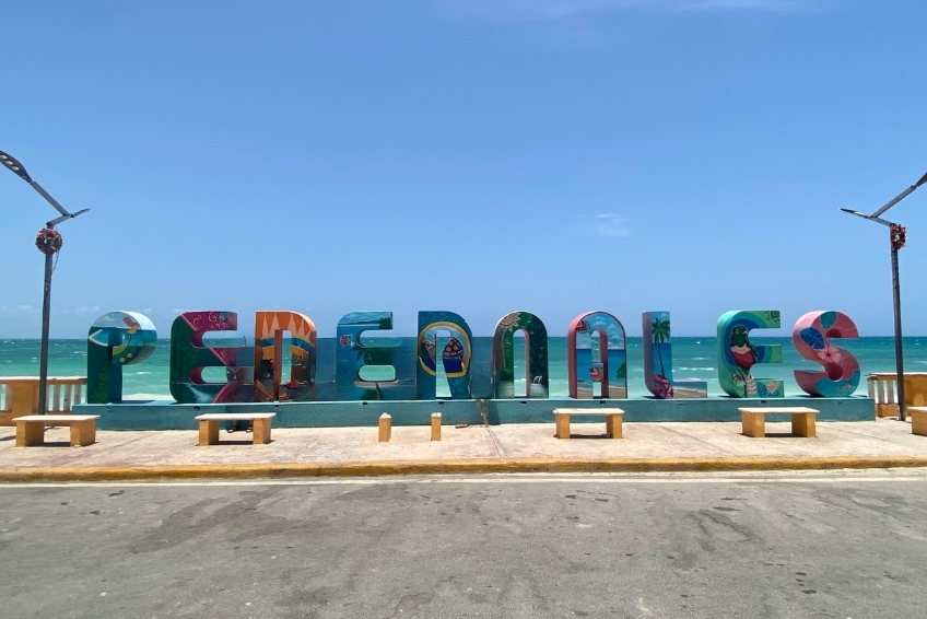
The nearest town is Pedernales, approximately 10 kilometers south of the park’s main southern entrance. Barahona is around 110 kilometers northeast and serves as the main base for visiting Cachote and the park’s eastern cloud forests. Santo Domingo is roughly 307 kilometers northeast by road, a drive of 4.5 to 5 hours or more. The new Cabo Rojo cruise port is about 30 kilometers from the park’s southern entrance gate, putting the park within a 45-minute drive of arriving ships.
How to Get to Sierra de Bahoruco National Park
Getting to Sierra de Bahoruco requires planning regardless of which entrance you use. The southern approach via the Alcoa Road from Pedernales is the most popular and the most accessible, with a paved road running most of the way. The northern approach via Puerto Escondido and Cachote requires a 4WD vehicle and significantly more time. There is no single visitor center serving the whole park. Entry points, fees, and road conditions vary by area. Plan your route, check conditions after rain, and do not underestimate how long mountain roads take.


Driving Yourself via the Alcoa Road (South Entrance)
A 4WD vehicle with high clearance is essential for anyone visiting Hoyo de Pelempito. This is not a suggestion. The dirt track in the upper section is frequently rutted, washed out after rain, and too rough for sedans or low-clearance SUVs.
From Pedernales, take Highway 44 east approximately 10 kilometers until you see the turnoff on the left (north) side of the road. Follow the road north through the mining terraces. The park entrance gate at La Charca sits at approximately kilometer 32. From there the road continues to the Hoyo de Pelempito Visitor Center and to various birding stops along the route. Allow at least two hours from Pedernales to the upper park areas.
From Barahona, take Highway 44 west toward Pedernales for approximately 84 kilometers, about 2.5 hours. Look for the park turnoff on the north (right) side of the highway and follow the route described above.


Driving Yourself to Cachote and Eastern Bahoruco (North Entrance)
This is a far more challenging area to visit. Cachote is the gateway to the park’s eastern cloud forest and requires a separate approach from Barahona. From Barahona, drive south on Route 44 approximately 20 kilometers to La Cienaga, then turn inland onto a rough, unmarked dirt road that climbs 16 kilometers to Cachote village at 1,100 meters elevation. This drive takes over an hour and requires a 4WD vehicle. Tour operators using dedicated off-road vehicles typically depart pre-dawn to arrive at the best birding conditions.


From the Cabo Rojo Cruise Port
The Alcoa Road junction is approximately 30 kilometers from the Cabo Rojo cruise port, about a 30 to 45 minute drive. Reaching the park’s birding areas at Aceitillar takes roughly 1.5 to 2 hours from the port each way, which is feasible as a shore excursion but leaves limited time inside the park. Independent operators run combined excursions from the port. Tour operators with park-specific experience are strongly recommended for cruise passengers.


Tours
The Sierra de Bahoruco is best experienced with a knowledgeable guide, particularly for birding. Roads are remote, signage is minimal, and the park’s most important wildlife requires knowing exactly where to look and when. Several operators run packages covering transport, guides, entrance fees, and in many cases accommodation and meals.
Tody Tours is the gold standard for Sierra de Bahoruco birding. Founded by Kate Wallace, a longtime resident birding guide who co-authored the definitive bird-finding guide to the Dominican Republic, Tody Tours operates Villa Barrancoli, the eco-lodge at Puerto Escondido that serves as base camp for virtually every professional birding tour visiting the northern slope. Their standard itinerary covers the Zapoten cloud forest at pre-dawn, the Rabo de Gato Trail, La Placa, and Cachote, targeting all 32 Hispaniolan endemic bird species.
Larimar EcoTour is the most versatile local operator, based in Pedernales. They run dedicated 2-day and 3-day Sierra de Bahoruco birding tours covering Cachote, the Rabo de Gato Trail, Zapoten, and La Placa with accommodation and all meals included. They also run general park access tours, scenic Alcoa Road drives, and combined packages pairing the park with Bahia de las Aguilas and Laguna de Oviedo. Guides are available in English, French, German, Italian, and Spanish.
Ecotour Barahona offers the most ambitious hiking option in the park: a 3-day sierra traverse starting at Paraiso on the coast, climbing through coffee plantations to Cachote on day one, traversing to Polo on day two, and descending to the coast on day three. They also run 4-day and 7-day birding packages based at Villa Barrancoli. This is the operator to contact if you want to walk through the park rather than drive it.
Cocotours handles private transfers from Santo Domingo, Punta Cana, and the Cabo Rojo cruise port with bilingual drivers. They also run shore excursions for cruise passengers with guaranteed return times. Best suited for visitors who want reliable logistics into the park rather than specialist guided experiences inside it.


The New Airport (Coming Soon)
The Cabo Rojo International Airport is under active construction near Oviedo, approximately 16 kilometers southeast of Pedernales. Completion of the main runway is targeted for September 2026, and the control tower for December 2026. The runway is designed to handle Boeing 777 aircraft at 3.1 kilometers. The airport was originally targeted for late 2025 before delays pushed the timeline to late 2026. Once operational, it will dramatically reduce the logistical barrier for reaching Sierra de Bahoruco and the entire Pedernales region for visitors flying from North America and Europe.
About The Park
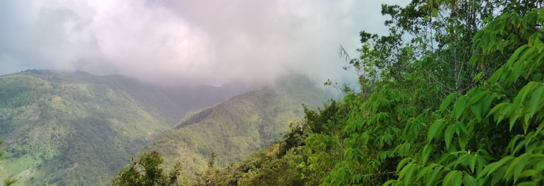
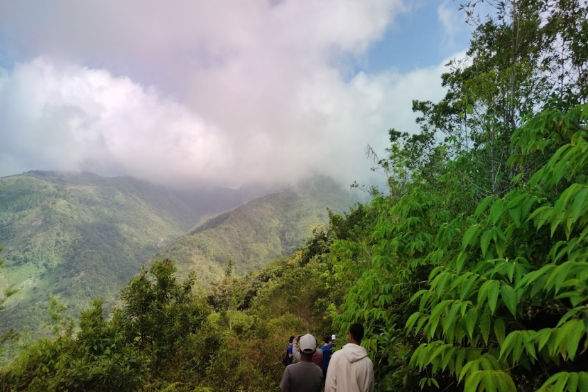
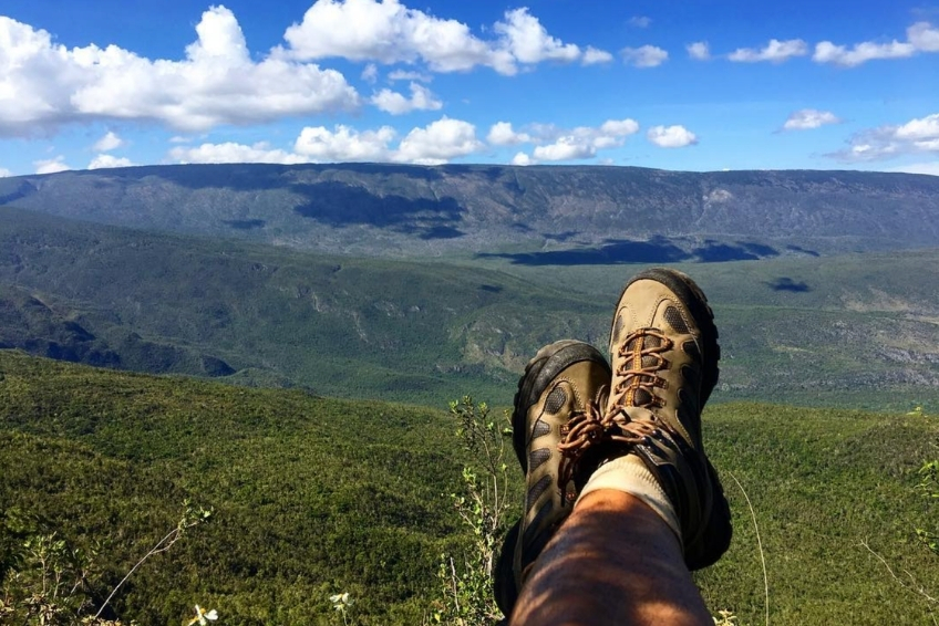
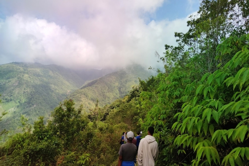
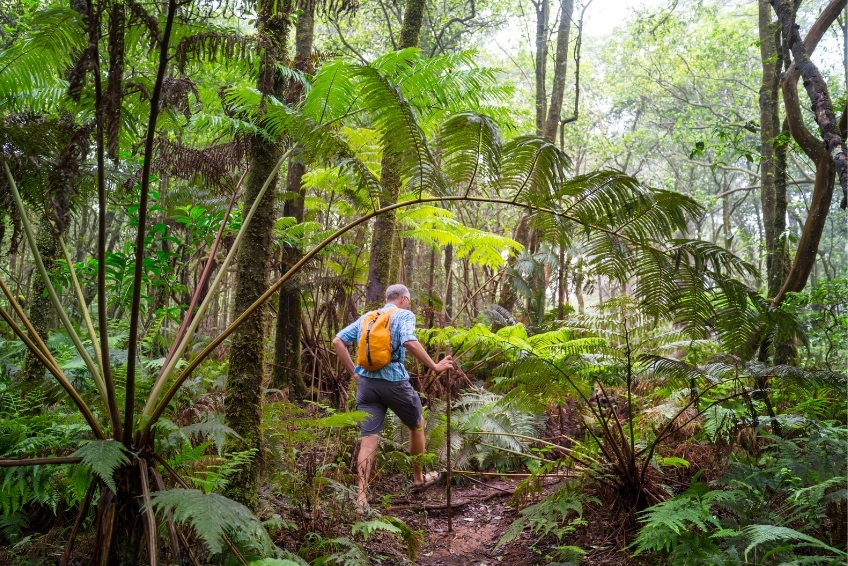
So you have driven the Alcoa Road for 90 minutes, watching the vegetation transform from cactus to pine to mist-draped cloud forest, and you park your vehicle at the Aceitillar plateau as dawn birds call through the trees. Or you have bounced up a pre-dawn mountain track to reach Villa Barrancoli, and you are now standing in darkness at the Zapoten cloud forest at 4:00 AM waiting for a La Selle Thrush to emerge. This is what Sierra de Bahoruco rewards. Those willing to put in the work to get there.


A Mountain Range Unlike Any Other in the Caribbean
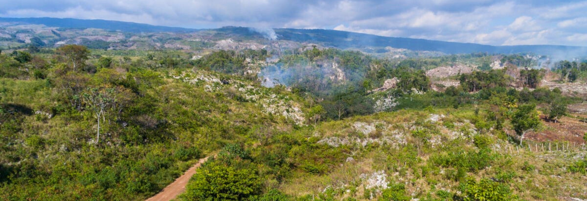
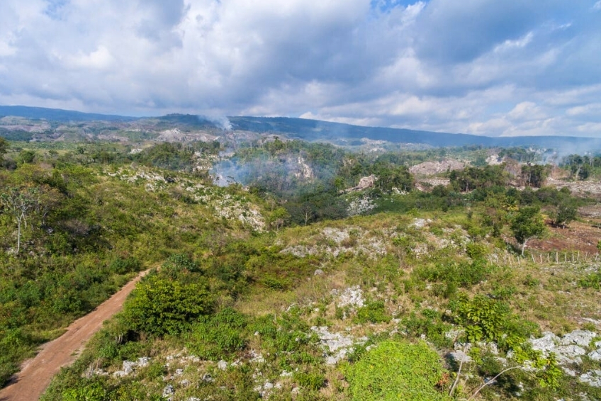
The Sierra de Bahoruco belongs to one of two ancient proto-islands that collided millions of years ago to form present-day Hispaniola. Its geological isolation over millions of years, combined with an elevation gradient that compresses eight distinct climate zones into a single mountain range, produced levels of endemism found nowhere else in the Caribbean. The park is designated a Key Biodiversity Area and an Alliance for Zero Extinction site specifically because it is the global stronghold for multiple Endangered species with no viable population anywhere else on Earth.
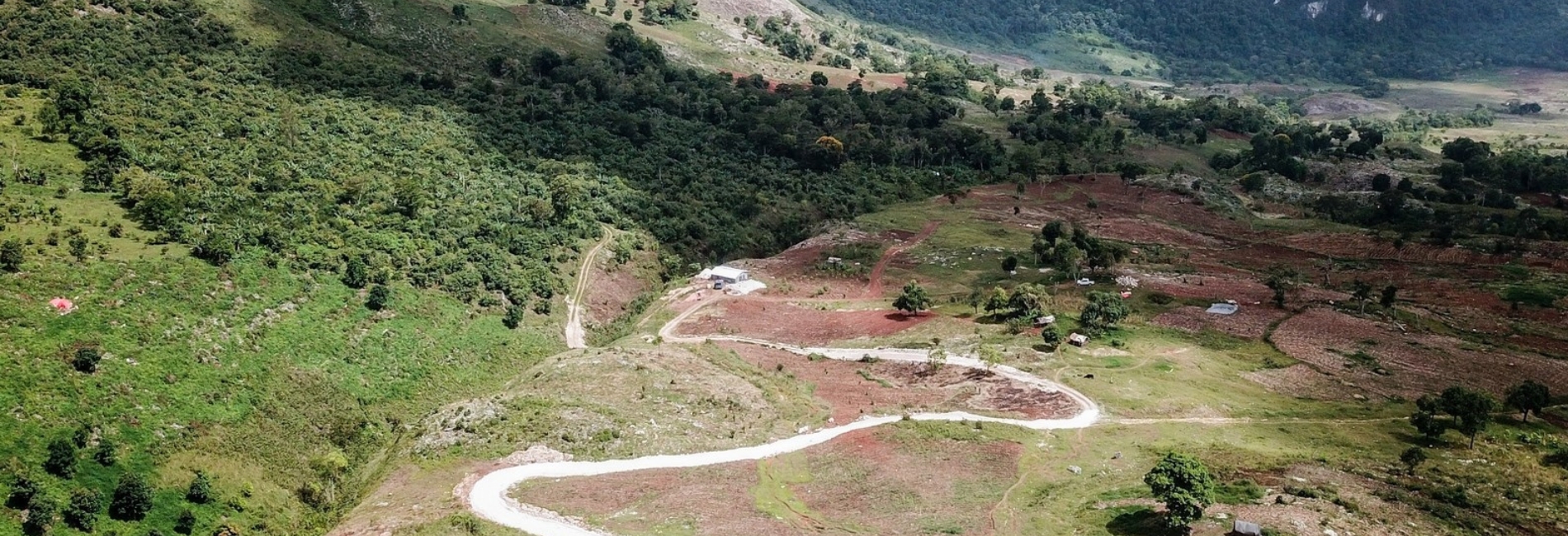
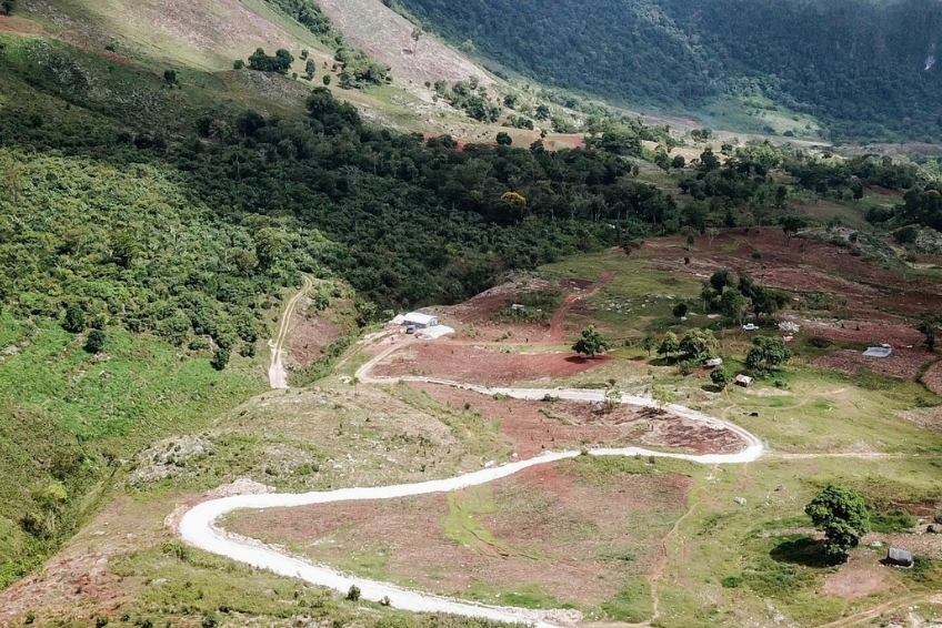
The range runs roughly 100 kilometers east to west, rising from limestone coastal terraces to the 2,367-meter summit of Loma del Toro. The underlying geology is a mix of Cretaceous volcanic rock overlaid with marine limestone, producing the karstic formations visible throughout the park including the famous Hoyo de Pelempito depression on the southern slope. The same mineral-rich geology that produces larimar, the rare blue gemstone found only in the Dominican Republic, lies beneath these mountains.


The Five Areas You Need to Know
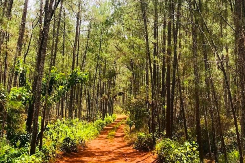
Aceitillar and the Alcoa Road form the park’s main southern gateway. The Alcoa Road, built by the mining company and now the park’s primary access route, passes through the most dramatic vegetation transitions in the DR before reaching the Aceitillar pine plateau. This is prime territory for Hispaniolan Crossbill, Golden Swallow, and Antillean Siskin. The Caribbean Birding Trail specifically lists Aceitillar as one of the best birding spots on the island. At kilometer 26, the Las Abejas canyon delivers parakeets, todies, and White-fronted Quail-Dove. The area also serves as the starting point for reaching the Hoyo de Pelempito viewpoint.
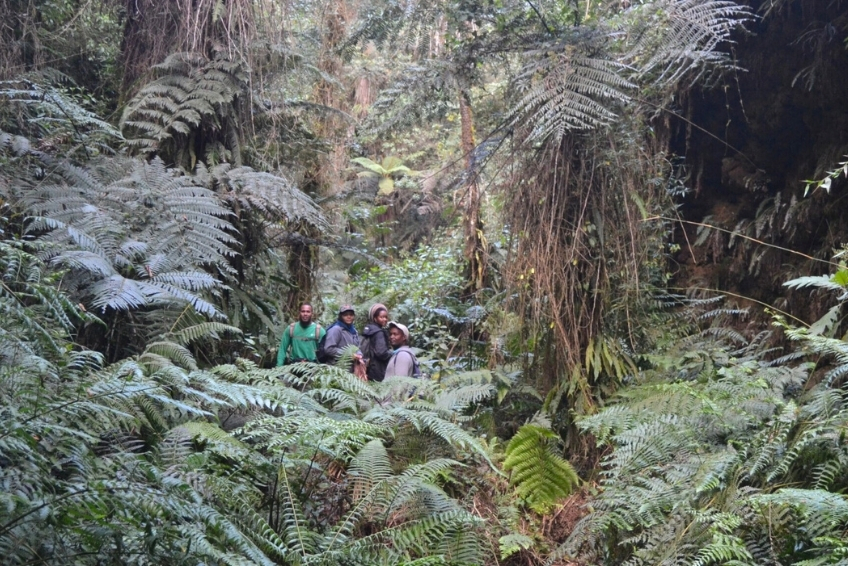
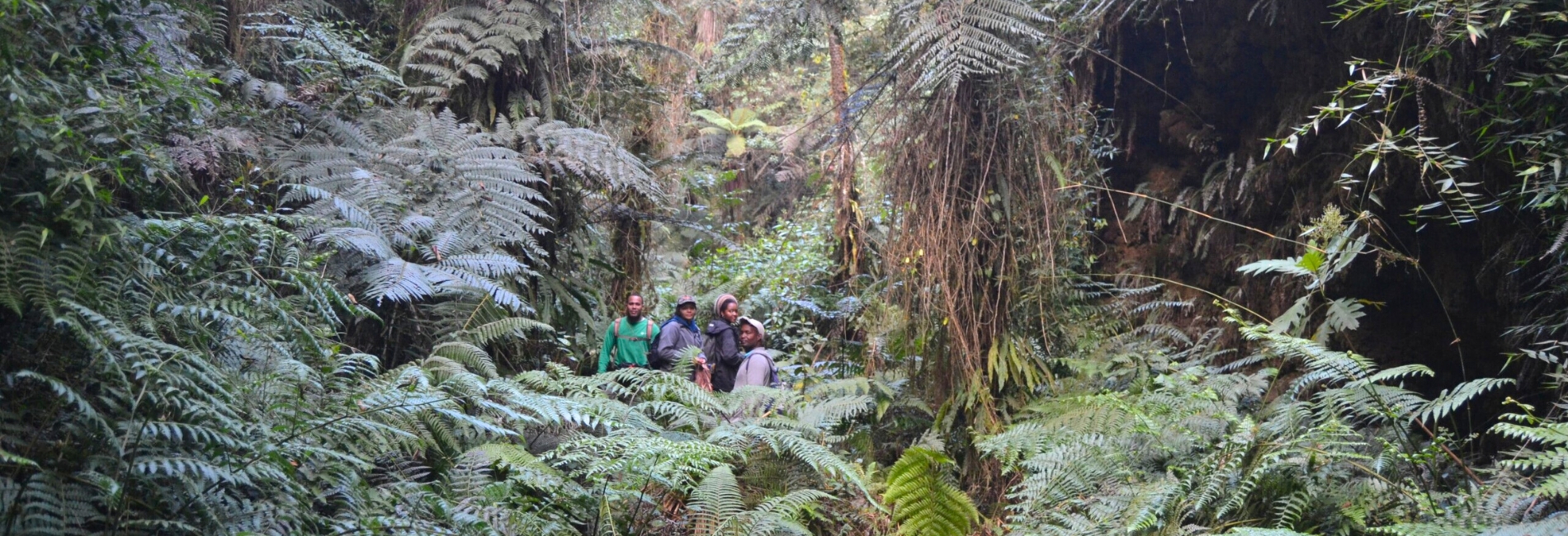
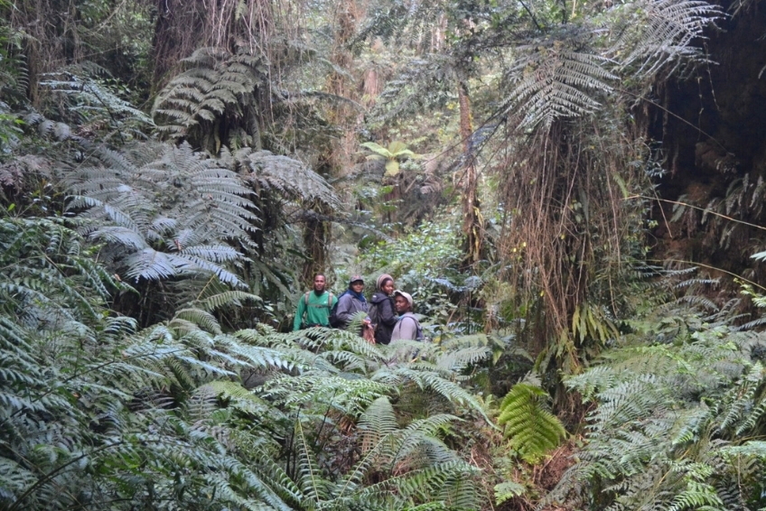
Cachote is the eastern gateway to the cloud forest, accessed from Barahona via a rough mountain road. This small farming community at 1,100 meters elevation sits within the Padre Miguel Domingo Fuerte Natural Monument and contains one of Hispaniola’s only magnolia forests, the island’s largest remaining stands of endemic manacle palm, and the only reliable site for the Eastern Chat-Tanager south of Lake Enriquillo.
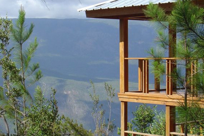
Puerto Escondido and Villa Barrancoli anchor the park’s northern slope. The national park administrative headquarters sits at Puerto Escondido, where the entrance fee is collected and where Villa Barrancoli eco-lodge has served as basecamp for professional birding expeditions for decades. Rough 4WD tracks from here lead into the Zapoten cloud forest.
Zapoten is reached by a pre-dawn 4WD departure from Villa Barrancoli. This cloud forest at over 1,200 meters elevation is the most reliable site on Earth for observing the Endangered La Selle Thrush, which feeds on the road at dawn before retreating into dense forest. It is also prime territory for the Western Chat-Tanager, Hispaniolan Trogon, and Bay-breasted Cuckoo.
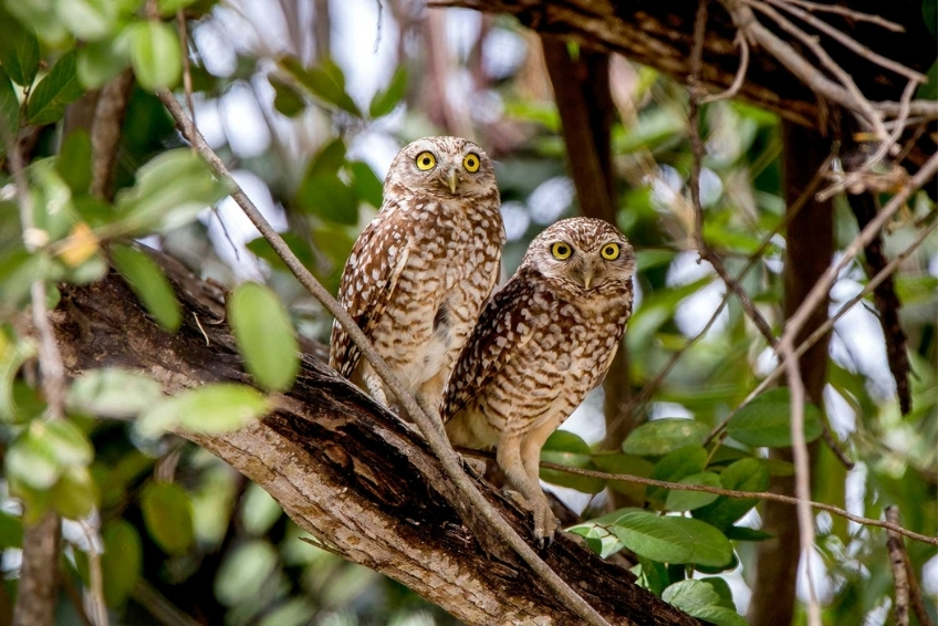
La Placa (also called La Plaigne) is a biological reserve near Puerto Escondido and the primary site for Bay-breasted Cuckoo, Flat-billed Vireo, and Burrowing Owl on the northern slope.


Biodiversity and Ecology
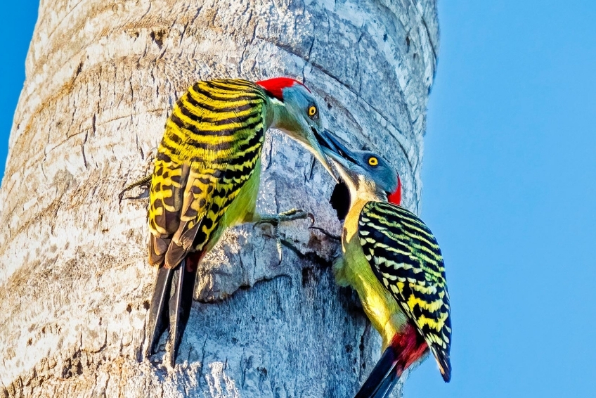
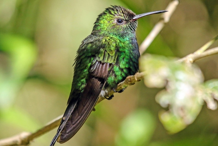
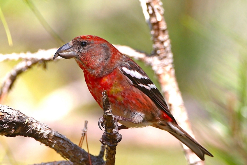
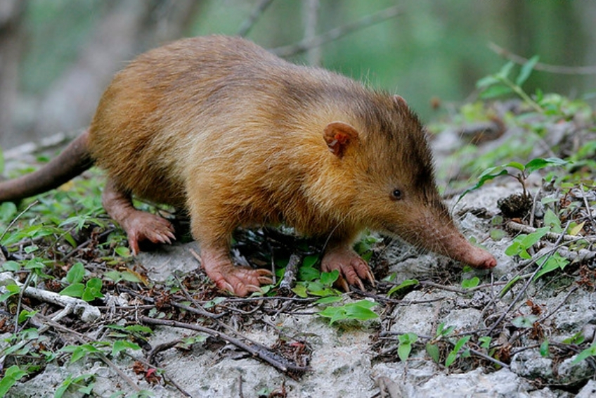
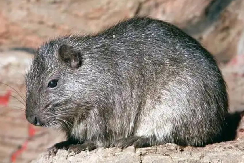
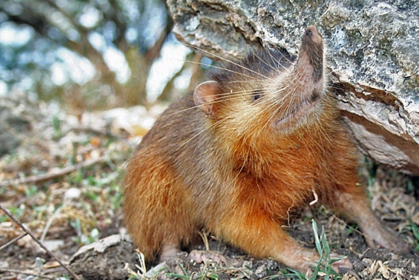
Sierra de Bahoruco harbors over 1,410 documented vascular plant species, representing 29 percent of Hispaniola’s entire flora in a single protected area. Among these are 166 orchid species (52 percent of all orchid species in the Dominican Republic), 94 endemic plant species, and the world’s largest known populations of the endemic juniper Juniperus ekmanii. The park shelters 30 of Hispaniola’s 32 endemic bird species, more than any other site in the Caribbean, including globally Endangered species: the Hispaniolan Crossbill, La Selle Thrush, Bay-breasted Cuckoo, and Golden Swallow. The park is also the last refuge for Hispaniola’s only two surviving native land mammals: the Hispaniolan Solenodon, a venomous insectivore that diverged from other living mammals 76 million years ago, and the Hispaniolan Hutia, an endangered nocturnal rodent.
Despite these protections, the park faces real pressure from illegal clearing, invasive species, and increasing visitor traffic as cruise ship arrivals grow and the new airport approaches completion. The window to experience it in its current largely wild state is narrowing. The park was created in 1983 and forms part of the Jaragua-Bahoruco-Enriquillo Biosphere Reserve, designated by UNESCO in 2002.


Infrastructure and Safety
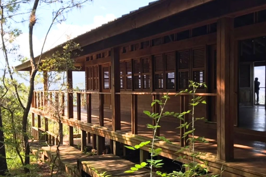
Facilities vary significantly by area. The Hoyo de Pelempito Visitor Center on the southern slope has restrooms, a picnic area, and interpretive displays in Spanish. Villa Barrancoli on the northern slope has screened cabins, hot showers, and a dining area. Beyond these two nodes, there are no restaurants, no cell service, and no emergency services of any kind within the park. Dirt tracks are rough, narrow, and can become impassable after rain. If your vehicle breaks down on a remote 4WD track, you are hours of walking from the nearest inhabited area with no phone signal.
The nearest medical facility for the southern slope is in Pedernales, approximately 30 kilometers from the southern entrance. Barahona has more comprehensive facilities at around 110 kilometers. Travel medical evacuation insurance is strongly recommended for any trip to this region. Cash is essential throughout. No ATMs exist near the park. Bring Dominican pesos from Barahona, Pedernales, or Santo Domingo.

Things To Do in Sierra de Bahoruco
The park rewards more than a single day. Here is what you can actually do, organized by what most visitors prioritize.
click to see more images
1. Birding at the Premier Caribbean Birding Site
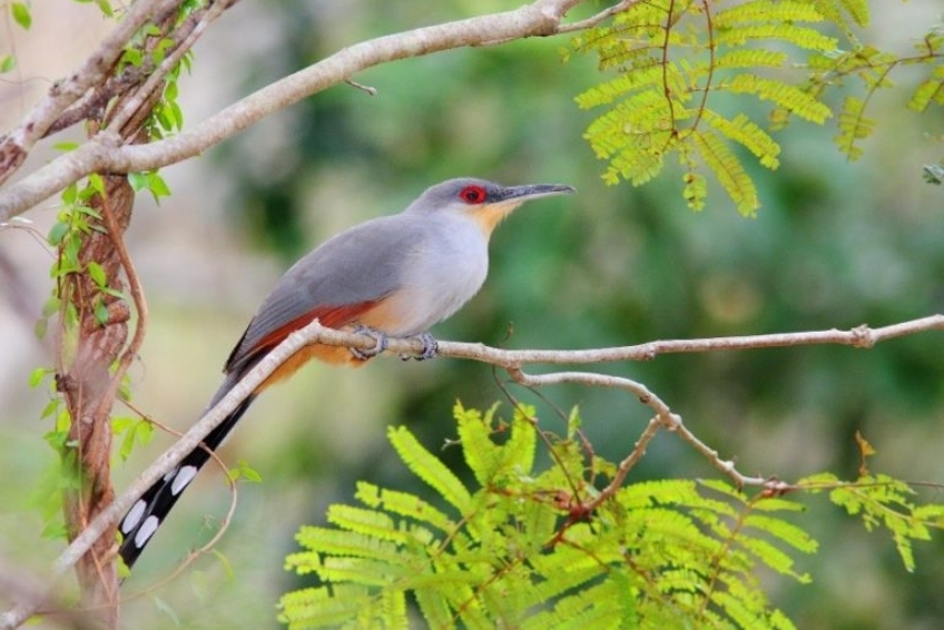
For serious birders, Sierra de Bahoruco is the reason to come to the Dominican Republic. The park holds 30 of Hispaniola’s 32 endemic bird species, including species found nowhere else on Earth. The Caribbean Birding Trail designates Sierra de Bahoruco as one of the most important birding sites in the entire region.
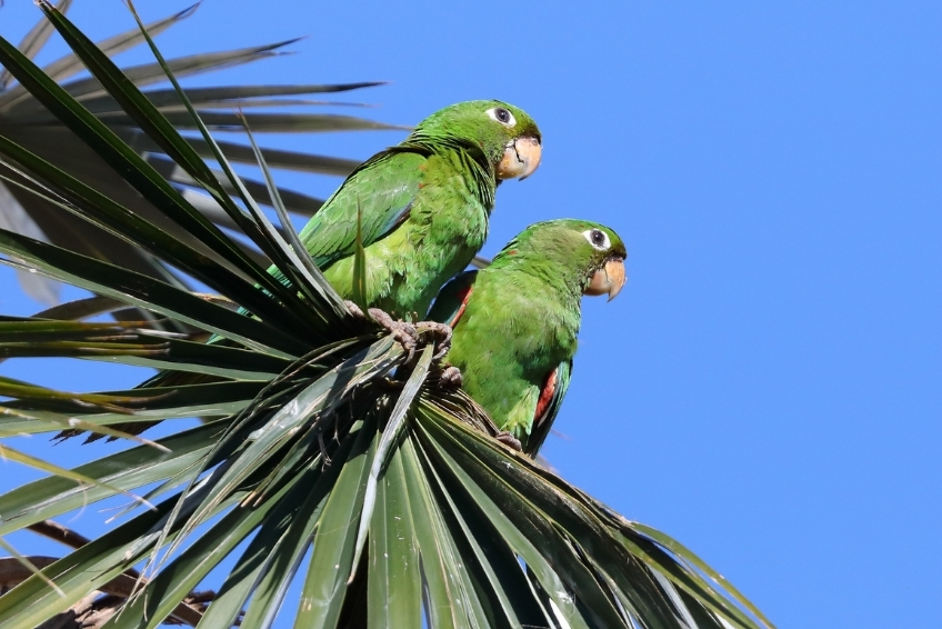
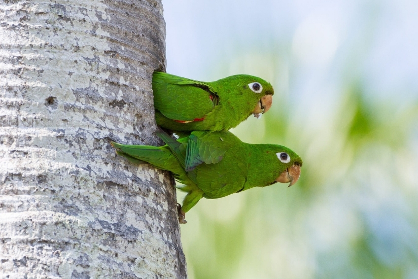
The Aceitillar pine plateau and the Alcoa Road are the primary birding areas on the southern slope. The Hispaniolan Crossbill, globally Endangered with a world population estimated at 1,000 to 3,375 individuals, is most reliably found near the park entrance water station and in the upper pine forest. The Golden Swallow, whose Jamaican subspecies is now presumed extinct, nests in abandoned bauxite mine pits along the road. The Hispaniolan Parrot and Hispaniolan Parakeet are active in the late afternoon near the Aceitillar plateau. The Las Abejas canyon at kilometer 26 is the best southern-slope site for both tody species and White-fronted Quail-Dove.
On the northern slope, Zapoten cloud forest requires a 3:30 to 4:00 AM departure from Villa Barrancoli. The payoff is the La Selle Thrush feeding on the road at dawn. The Rabo de Gato Trail at Villa Barrancoli is a one to two hour walk through gallery forest delivering Hispaniolan Lizard-Cuckoo, both tody species, and excellent hummingbird photography at Chinese hat flowers. La Placa is the primary site for Bay-breasted Cuckoo, the most sought-after and difficult of Hispaniola’s endemics.
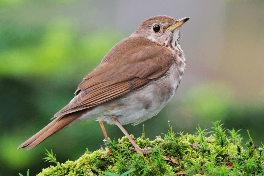
Cachote adds Eastern Chat-Tanager and Rufous-throated Solitaire to the target list. The Bicknell’s Thrush, a Vulnerable species that breeds only in the northeastern United States and Canada, winters principally in these cloud forests.
click to see more images
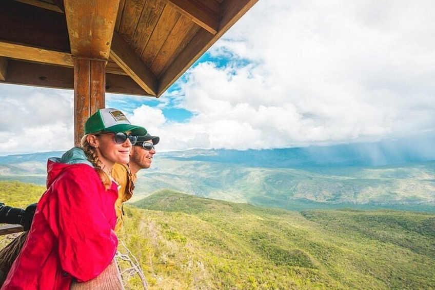
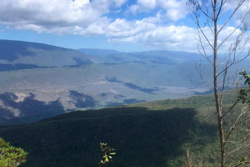
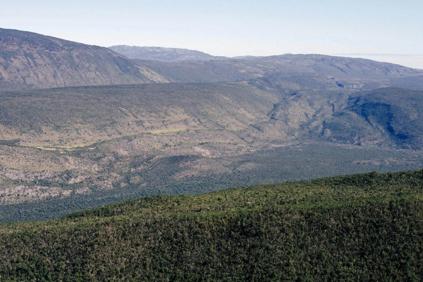
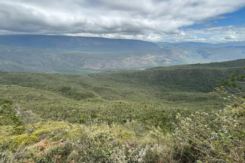
2. The Hoyo de Pelempito Viewpoint
Hoyo de Pelempito is the park’s most dramatic single sight. This massive collapsed depression, roughly 7 kilometers long, up to 4.8 kilometers wide, and over 700 meters deep from rim to floor, is accessed via the Alcoa Road from the southern entrance. A wooden observation platform at the rim offers unobstructed views across the entire depression, with clouds gathering in the valley below and the mountain walls rising on all sides. The best light is early morning or late afternoon. Read our full Hoyo de Pelempito Visitors Guide for complete logistics, including driving instructions, the tour options available from the Cabo Rojo cruise port, and what to expect on the road up.
click to see more images
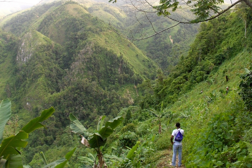
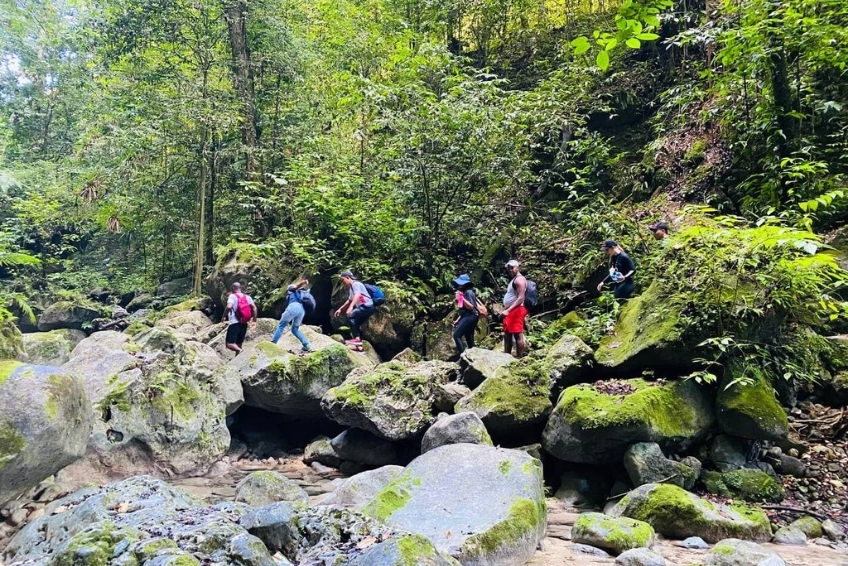
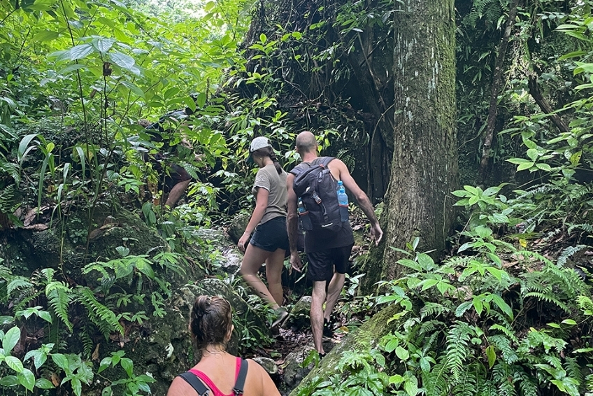
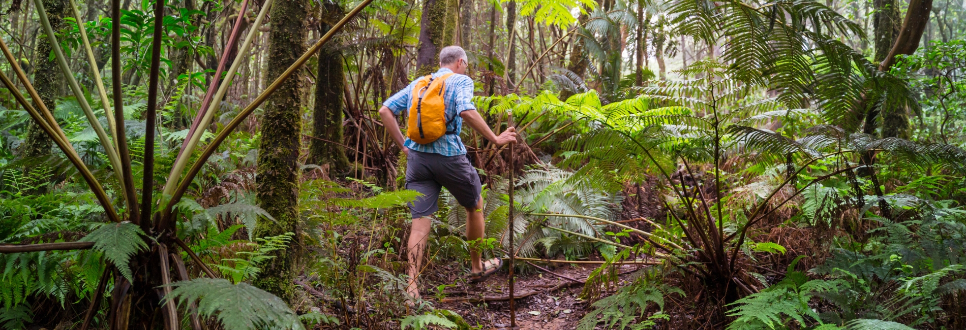
3. Hiking and Trekking
The most ambitious hiking option is Ecotour Barahona‘s 3-day sierra traverse: day one follows the Cafe de las Mujeres trail from Paraiso through coffee plantations to Cachote, a 6-hour ascent of 1,100 meters; day two traverses from Cachote to Polo via Rio Cortico and La Mina; day three descends from Polo to Paraiso following the Rio Nizaito. Overnight stays in mountain huts and village homes are included.
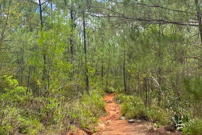
Shorter options include the Rabo de Gato Trail at Villa Barrancoli (1 to 2 hours, easy to moderate), the Cachote botanical trail with its fish pond and magnolia forest, and the Los Arroyos cloud forest trail. Short nature walks with plant identification signs also branch from the Hoyo de Pelempito Visitor Center. None of these shorter trails are strenuous. They reward slow walkers who pay attention to what is growing around them.
click to see more images
4. Wildlife Spotting
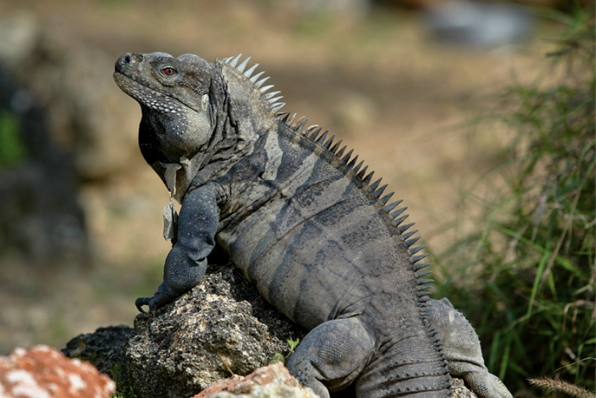
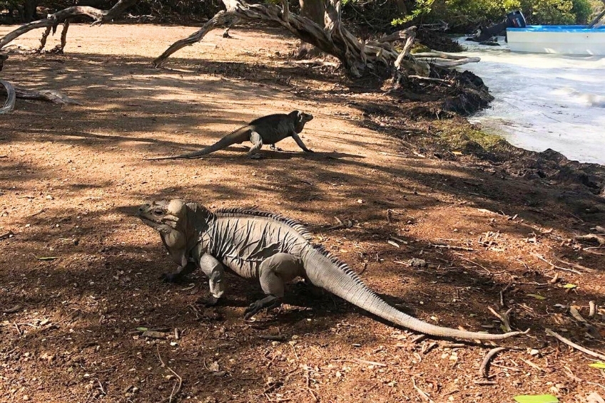
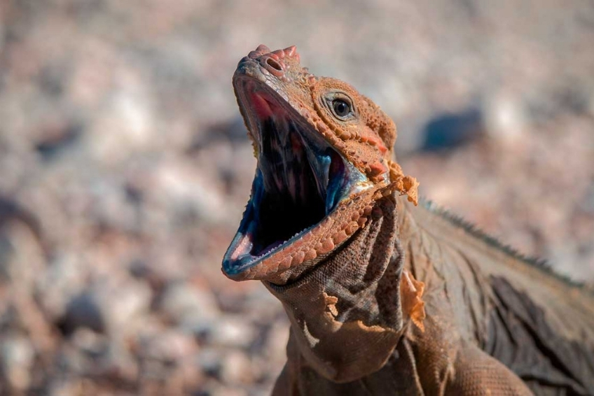
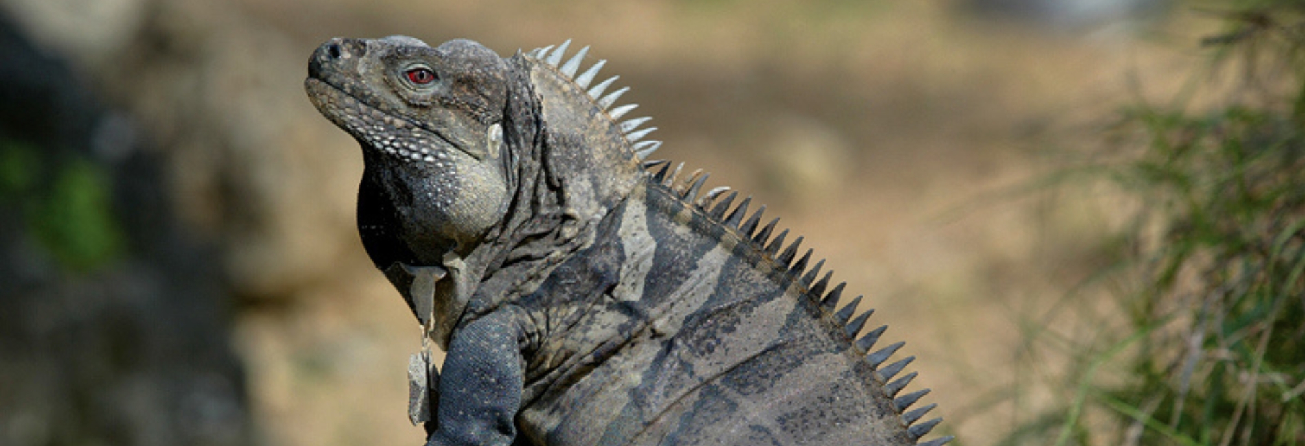
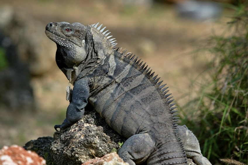
Rhinoceros Iguanas are commonly spotted at lower elevations throughout the park. The critically Endangered Ricord’s Iguana, with a global population of just 3,000 to 4,000 individuals, inhabits the xeric lowlands near the park’s southern edge. The broader Jaragua-Bahoruco-Enriquillo region is the only place on Earth where two Cyclura iguana species overlap, a geographic distinction found nowhere else.
The Hispaniolan Solenodon, one of very few venomous mammals on Earth and one of only two that deliver venom through specialized teeth, diverged from other living mammals some 76 million years ago. It inhabits the park’s forested zones but is nocturnal and almost never seen by day visitors. Night excursions with the park’s head ranger Nicolas Corona from Pedernales, or through specialist operators, offer genuine chances of encounter. The Hispaniolan Hutia, also nocturnal and endangered, favors broadleaf forest with high canopy.

click to see more images
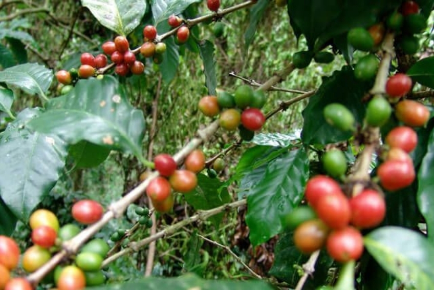
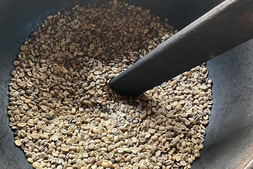
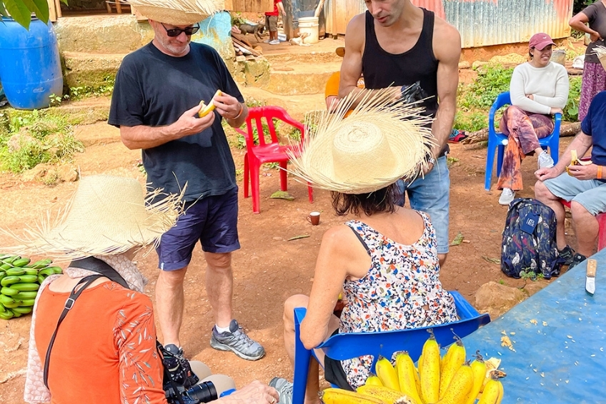
5. The Polo Coffee Tour
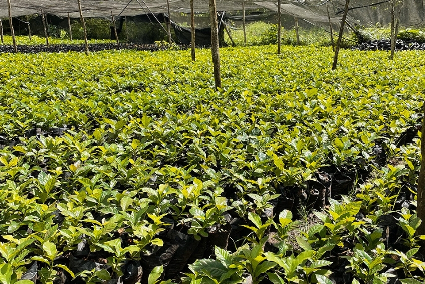
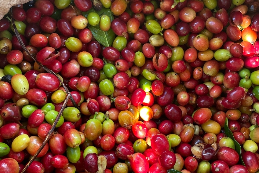
The mountains above Polo produce what many coffee experts consider the Dominican Republic’s finest beans: shade-grown Arabica Típica at 700–1,300 meters, almost entirely organic by practice. The harvest runs September through May, with processing most visible November through January.
Larimar EcoTour runs a dedicated half-day coffee tour from Pedernales covering the Chi Cui plantation trail, a tree-to-cup production demonstration at the Cooperativa Simona Esmeralda Feliz, a stop at El Polerito Coffee Shop, and the Polo Magnetico on the way back. It is a genuinely good half-day that pairs well with a morning birding start on the Alcoa Road. Ecotour Barahona weaves the coffee experience into its 3-day sierra trek. The first day literally starts on the “Café de las Mujeres” trail climbing through active plantations to Cachote.
The region’s coffee calendar peaks in October with FestiCafé, an annual organic coffee festival that has been running since 2004 and reached its 17th edition in 2025. That edition featured plantation tours, expert panels, Dominican traditional music including atabales and sarandunga, an artisan fair, and a cycling race through the mountains. If you are visiting in October, it is worth planning around.
click to see more images
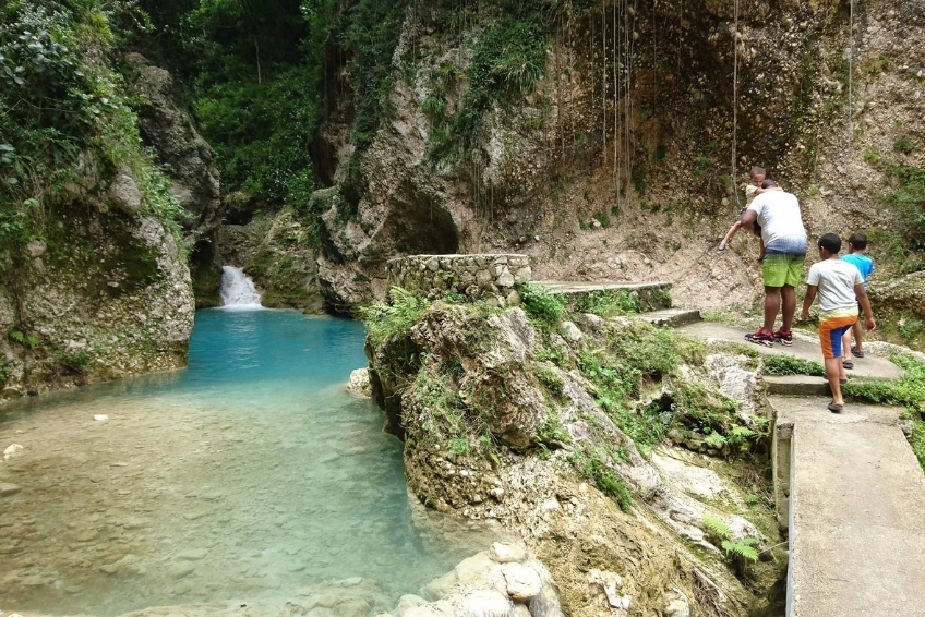
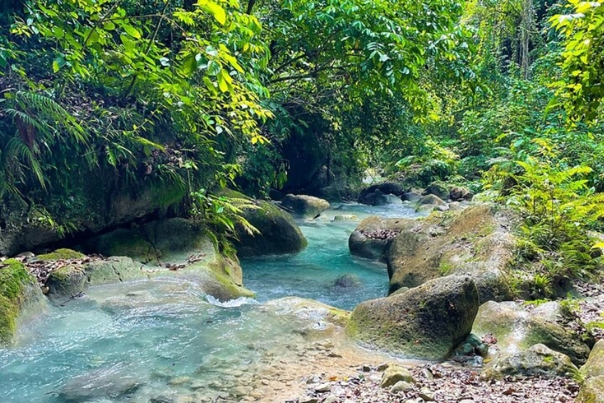
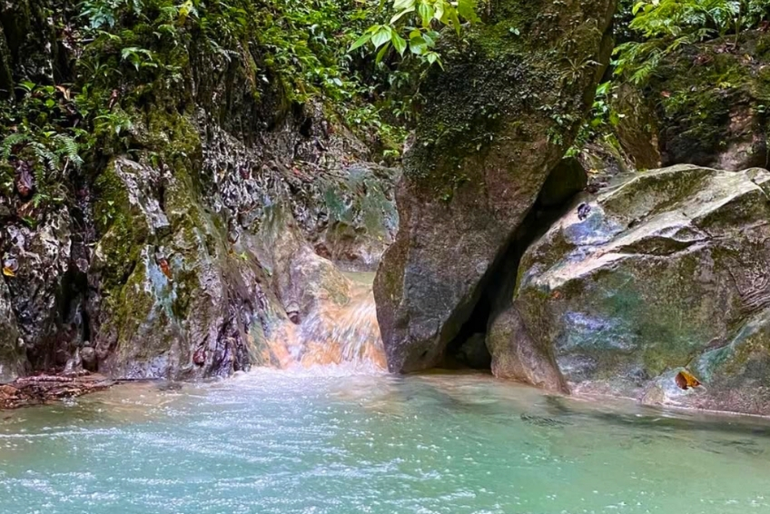
6. Waterfalls and Natural Pools
The sierra’s eastern flanks spill down into some of Barahona Province’s most rewarding natural swimming spots, all fed by cold mountain water descending from inside the park.
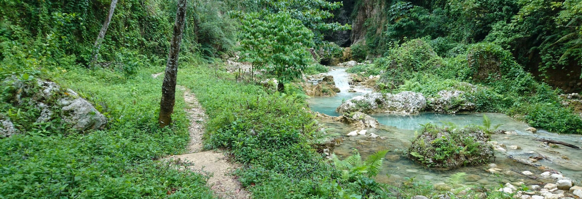
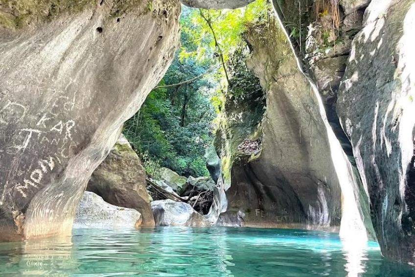
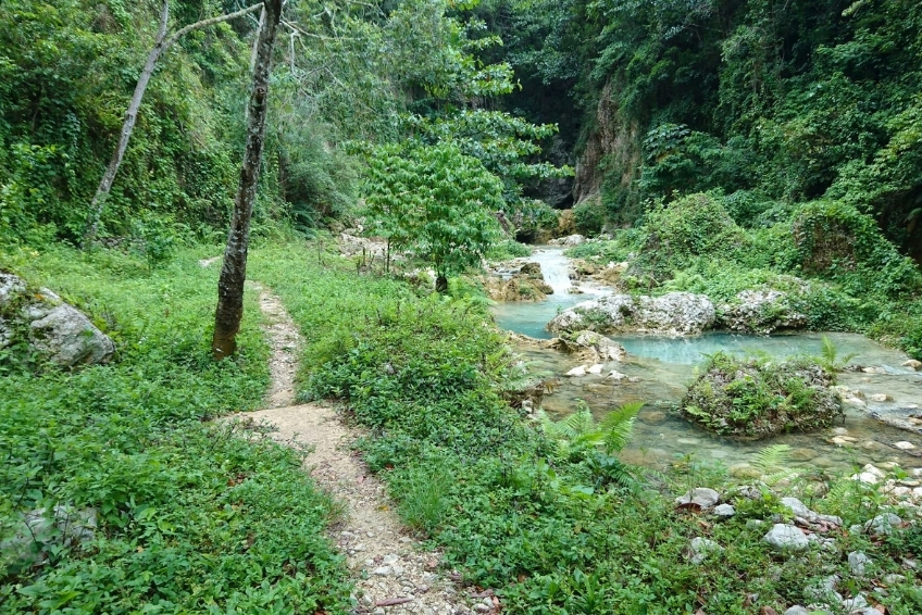
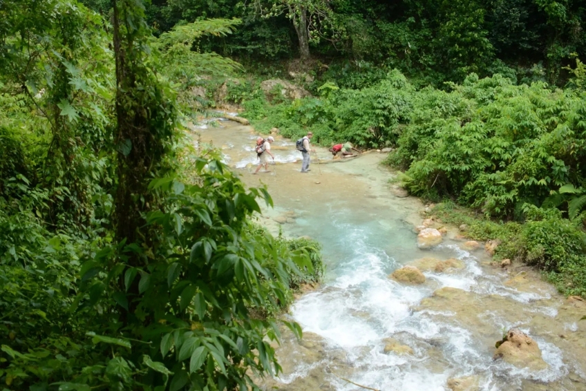
Balneario La Plaza near La Ciénaga is the standout. A series of three to four cascading falls along the Bahoruco River drops through a narrow canyon into crystal-clear pools at each level. Getting there requires a short 4WD drive to the trailhead followed by a one to two hour riverside hike that crosses the river roughly eight times. Worth every crossing. Larimar EcoTour runs guided excursions here.
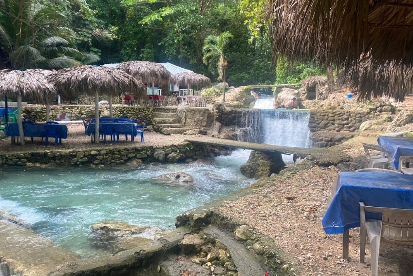
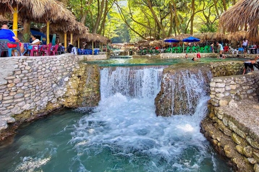
Balneario San Rafael sits directly on the coastal highway about 25 kilometers south of Barahona city. A cold mountain cascade descends from the Sierra de Bahoruco through a series of natural rock pools and into the Caribbean just below. Easy access, free entry, and flanked by fish shacks selling fried snapper. It is one of the most photogenic spots on the entire southwest coast and takes no planning whatsoever.
Balneario Mata de Maíz is a natural pool just 15 minutes by vehicle from Polo where several rivers converge at the source of the Río Nizaito. Cold, clean mountain water in a forest setting that local families use every weekend. Combine it with the coffee tour for a full day out of Polo.
click to see more images
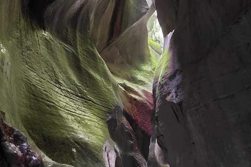
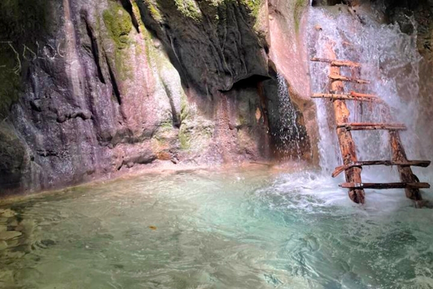
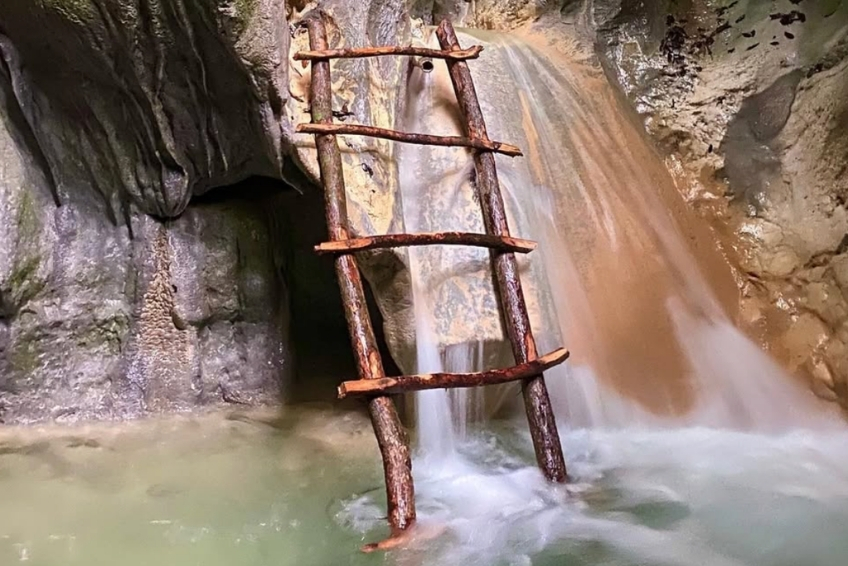
7. Cueva de la Virgen
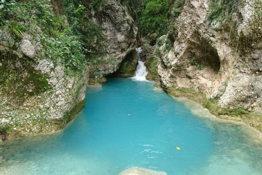
A short half-day adventure accessible from La Ciénaga on the Barahona coast. A 30-minute rainforest hike leads to a narrow canyon called the Garganta del Diablo, a slot gorge where the trail continues through calf-deep water into a cave containing emerald-colored pools and a small waterfall. The combination of jungle, canyon, cave, and swimming hole is unusual enough that it draws its own dedicated visitors rather than just add-ons from other park activities.
Larimar EcoTour runs it as a guided half-day. GuanAventuras, the women-led cooperative from La Ciénaga, also offers it at lower prices. Find them through their Facebook page or arrange through your hotel in Barahona.
click to see more images
8. Nearby Attractions Worth Combining
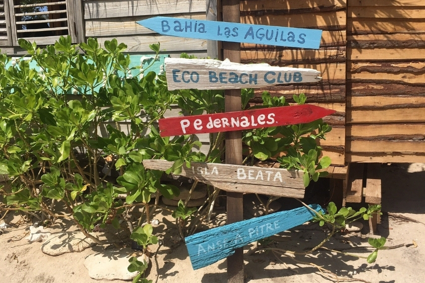
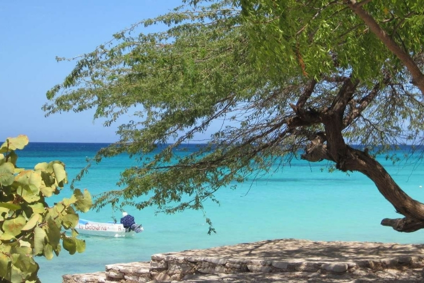
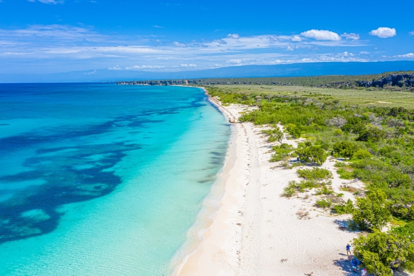
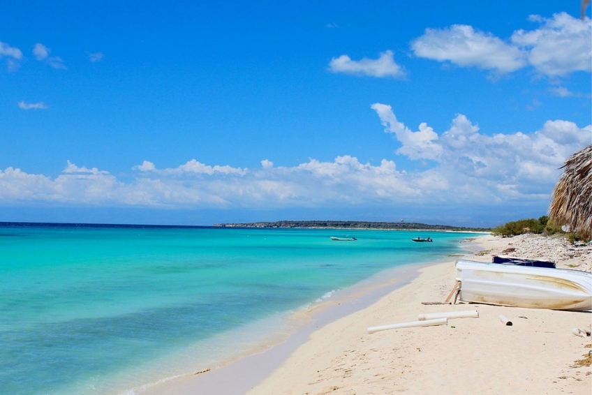
Bahia de las Aguilas is the obvious pairing. The beach is about 45 minutes from the park’s southern entrance, and most operators run combined full-day excursions. Start early at the park when the light and temperature are best, then head to the coast in the afternoon.
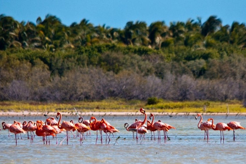
Laguna de Oviedo is about 55 kilometers east of Pedernales on Highway 44. Adding the lagoon, Bahia de las Aguilas, and the park’s southern slope in a single day is aggressive but doable with an early start and a reliable 4WD. Two days based in Pedernales is far more comfortable and allows time to do each site properly.
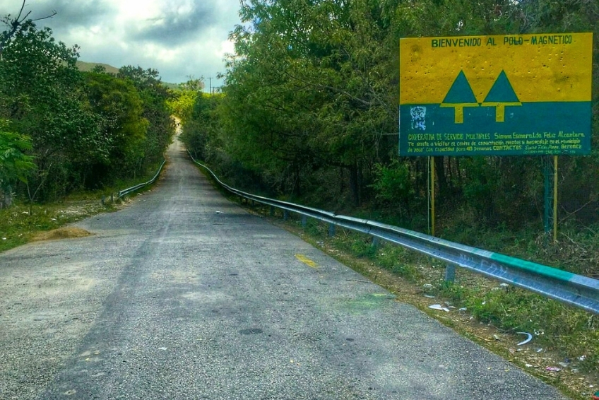
The Polo Magnetico, a gravity hill optical illusion near the town of Polo in Barahona Province, lies on the Cabral-Polo highway within the broader Sierra de Bahoruco region. Vehicles in neutral appear to roll uphill due to the surrounding terrain distorting visual perception. It is a quick roadside curiosity on the Barahona-to-Cachote approach route rather than a destination in its own right.
Where to Eat near Sierra de Bahoruco
There is no food inside the park at any of its main access areas. Villa Barrancoli on the northern slope includes dinner for birding tour participants, and the Cachote community ecotourism center can arrange meals with local cooks with advance notice. Beyond these, you need to bring your own food and water into the park, full stop.


In Pedernales
Bocanye, Grill and Seafood on Calle Libertad is a solid Caribbean seafood spot with a varied menu and good portions. It is one of the better homestyle restaurants in town and worth a visit, especially if you are staying more than one night.
Restaurante Jalicar on Calle Libertad is the best value meal in town. Generous family-style plates of pescado frito, lambi al ajillo, and chicken with rice and beans for around RD$1,000 ($17 USD) for the table. No frills, just excellent home-cooked Dominican seafood at prices that feel like a steal.
El Navio Bar and Seafood sits right on Pedernales Beach with a sustainable-fishing-focused menu of lobster, red snapper, and conch. The best spot in town for a sunset meal. It can be pricey for Pedernales, and it gets crowded on cruise ship days.
Hotel Pedernales Italia serves homemade Italian-Dominican dinners to guests that are genuinely excellent. If you are staying there, do not miss the evening meal.
Check our Pedernales Visitors Guide for a full dining rundown.


In Barahona (for Cachote visitors)
Barahona has a wider dining selection. Brisas del Caribe is the local favorite for Caribbean seafood. Delicias Marinas specializes in lobster and shrimp. La Rocca, adjacent to Hotel Caribe on the seafront, offers fresh fish in a relaxed setting. Pat’s Organic Garden at Casa Bonita Tropical Lodge is the area’s upscale option for organic farm-to-table dining with Caribbean and Creole influences.


What to Order
Traditional dishes worth seeking out:
- Mofongo (mashed plantains with garlic, often stuffed with seafood)
- Pescado frito (whole fried fish with moro rice and tostones)
- Lambi (conch, prepared various ways)
- Sancocho (hearty stew with multiple meats and root vegetables)
- Cangrejo con tostones (crab with fried plantains)
For something quick and easy, many street vendors sell empanadas and yaniqueques (fried dough) for pocket change. Meals across the region typically cost RD$300–1,000 ($5–$17 USD). Cash only at virtually every establishment. Check out our Dominican Republic Food Guide for more on what to eat and how to order.
Where to Stay
Accommodation options depend on which part of the park you are visiting. For the southern slope and Hoyo de Pelempito, Pedernales is the closest base, putting you about 45 minutes from the park entrance. For Cachote and the eastern cloud forests, Barahona works best. For the northern slope birding at Zapoten, Rabo de Gato, and La Placa, Villa Barrancoli inside the park is the only practical choice.
Inside the Park (Northern Slope)


Villa Barrancoli
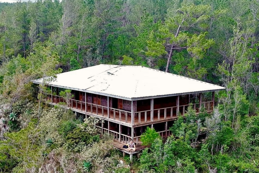
Villa Barrancoli at Puerto Escondido is the basecamp for virtually every professional birding expedition visiting the northern slope. Six screened cabins each sleep two, with a shared bathhouse with hot showers, open dining area, and free WiFi. Tent camping is available at $15 per night with equipment provided. Rates for cabin accommodation with dinner are around $75 per person per night. Book through todytours.com.


Centro Ecoturistico Canto del Jilguero
Centro Ecoturistico Canto del Jilguero in Cachote is a community-run facility with shared cabins accommodating up to 25 people, a communal dining area, and camping options. Meals are arranged with local cooks and must be booked in advance. This is the place to stay if your focus is Cachote cloud forest and you want a genuine community ecotourism experience.
In Pedernales


Hotel Pedernales Italia
Hotel Pedernales Italia (around $37–44/night) is run by Italian couple Gianni and Viviana and is the most consistently recommended property for park visitors on the southern slope. Clean, air-conditioned rooms, breakfast included, and homemade Italian-Dominican dinners that are genuinely the best food in Pedernales. Gianni’s knowledge of the surrounding area is encyclopedic. The only caveat is that he speaks Spanish and Italian but limited English, so a translation app helps. Eight rooms that fill fast. Check Prices here


Hotel Vista de Aguilas Ecolodge
Hotel Vista de Aguilas Ecolodge (around $69–82/night) is the nicest physical property in Pedernales, with handmade wooden furniture, seashell lamps, a small pool, spa services, and an on-site restaurant. The staff helps with tour planning and logistics. Our only note is that dinner options are limited on-site, so plan to eat elsewhere on multi-night stays. Check Prices here


Hostal Dona Chava
Hostal Dona Chava (around $30–45/night) is a family-run 21-room guesthouse in its third generation of operation. The lush garden courtyard, rocking chairs, and bar where travelers swap stories make it the most atmospheric budget option in the region. Rooms have air conditioning and the location near the bus stop is convenient. Check Prices here
In Barahona


In Barahona
Barahona offers better amenities and wider choice for those visiting Cachote and the eastern park. Casa Bonita Tropical Lodge is the luxury standout, a Small Luxury Hotels of the World member with an infinity pool, ocean views, and an organic garden restaurant (around $150–250+/night). Check Prices here
Hotel Caribe (around $58/night, breakfast and dinner included) is the most popular mid-range choice and reliably well-reviewed. Check Prices here
Hotel El Quemaito (around $121/night) is an oceanfront option with a pool. Check Prices here
Hotel Loro Tuerto (around $25–30/night) is the best budget value in Barahona, rated 8.5 on Booking.com. Check Prices here


What's Coming Soon
The Cabo Rojo mega-resort development will transform the accommodation landscape for the park’s southern approach by the late 2020s. Iberostar Cabo Rojo (588 rooms) is expected to open in early 2027 as the first major all-inclusive. Secrets Hyatt (507 rooms) and Dreams Hyatt (504 rooms) are targeted for 2027. The long-term plan calls for 12,000 hotel rooms in the region by 2033 from chains including Hilton, Marriott, and Sunwing. The Pedernales of 2030 will look nothing like the Pedernales of today.
What to Pack
Sierra de Bahoruco demands preparation that most Caribbean trips do not. You can start the day at sea-level temperatures above 30°C and be shivering in 15°C cloud forest by mid-morning. There are no vendors, no facilities beyond basic restrooms at the main access points, and no cell service anywhere in the park. Forget something critical, and you are stuck without it.
The Essential Packing List
- A warm jacket or fleece (non-negotiable). Temperatures at Zapoten, Cachote, and the upper Alcoa Road can be 15°C cooler than at the coast. Dawn birding at Zapoten at 4:00 AM is cold. Multiple experienced visitors have been caught off-guard by this.
- Sturdy closed-toe hiking shoes or boots. The trails are rocky, roots are exposed, and some terrain drops sharply near viewpoints.
- At least 2 liters of water per person. No vendors anywhere near the park’s main areas.
- Snacks and food. The drives and trails take longer than expected. There is nothing to buy.
- Binoculars (essential for birders, useful for everyone). The bird life here is exceptional. Even non-birders will want them at Hoyo de Pelempito.
- Insect repellent. Less critical than at the lagoon, but useful in forested sections.
- Headlamp or torch. Required for pre-dawn departures to Zapoten and night wildlife walks.
- Camera with telephoto lens. For birds and wildlife in the forest. A wide-angle lens for the Pelempito panorama.
- Rain gear. The cloud forest is often wet regardless of the season. A waterproof layer is worth carrying year-round.
- Reef-safe sunscreen (SPF 50+) and a wide-brimmed hat. High elevation intensifies UV exposure even when the air feels cool.
- Cash in Dominican pesos. For entrance fees and any roadside stops. No ATMs exist anywhere near the park.
- Full tank of gas. Fill up in Pedernales or Barahona before departing. No fuel stations on any park road.
- Offline GPS or downloaded maps. Cell service disappears well before you reach any of the park’s main areas.
Best Time to Visit
Sierra de Bahoruco receives significantly more rainfall than the dry Pedernales coast, and the cloud forest areas at Cachote and Zapoten can be wet in any month. The region has a bimodal rainfall pattern, with wet peaks in May–June and September–October separated by a relative dry spell in July–August. Road conditions and what you will see both vary considerably with the seasons.
Dry Season (December through April)
This is the optimal window for most visitors. Road conditions are most reliable throughout the park, temperatures are comfortable at elevation rather than frigid, and birding is at its absolute peak. Resident endemic species are vocal and displaying, and North American migrants including the Bicknell’s Thrush are still present in the cloud forests. February and March are particularly good months for covering multiple park areas in a single trip.
Shoulder Season (May through June)
These months are the transition into the wet season and can be excellent for visiting. Temperatures push higher on the coast but remain comfortable at elevation. The vegetation is at its lushest and the Alcoa Road’s vegetation transitions are most dramatic. However, May and June also bring the first of the year’s two rainfall peaks. Unpaved roads including the Cachote access can become unpredictable after heavy rain, and you should check conditions before departing.
Rainy Season (July through November)
The Barahona region’s rainfall is bimodal. July and August are actually drier months despite technically falling within the wet season, as the Azores High pushes storm tracks away from the southwest coast during this window. The second and more intense rainfall peak arrives in September and October, when Cachote’s access road can become impassable, the Zapoten 4WD tracks are unreliable, and hurricane season reaches its peak. Cloud cover in the cloud forest can be dense, occasionally obscuring visibility at Pelempito, though it can also produce extraordinary atmospheric effects. If you go during September or October, go early in the morning before afternoon storms develop, check road conditions before departing, and carry travel insurance with cancellation coverage. November begins the transition back to drier conditions.
Time of Day
For birding at Zapoten and Cachote, pre-dawn departures are not optional. They are the only way to see the most sought-after species before they retreat into dense forest. For the Pelempito viewpoint, early morning and late afternoon deliver the best light and the most dramatic cloud formations in the depression below. Midday in summer at sea level is punishing. Start early every day.
Sierra de Bahoruco National Park FAQ
Frequently Asked Questions
Do I need a 4WD to visit Sierra de Bahoruco?
It depends on where you are going. The paved Alcoa Road is accessible in any vehicle as far as the park entrance gate at Aceitillar. A 4WD with good ground clearance is mandatory for reaching Hoyo de Pelempito, for all Cachote access, for Villa Barrancoli on the northern slope, and for Zapoten. If you do not have a 4WD, book a guided tour with an operator who does. Check Larimar EcoTours or Ecotour Barahona for current options.
How much does it cost to enter the park?
The national park entrance fee is approximately 200 Dominican pesos for foreigners (around $3 to $4 USD). Bring cash in Dominican pesos. Guided tour pricing varies by operator, duration, and route. Check larimarecotour.com and todytours.com for current packages.
How long should I spend at Sierra de Bahoruco?
Serious birders typically spend 3 to 5 days covering all the main hotspots. A general visitor wanting to experience the Alcoa Road, the Pelempito viewpoint, and Cachote should allow a minimum of 2 days based in Pedernales or Barahona. A single day is possible for a taste of the park’s southern slope but does not do justice to the range of habitats available.
Can I visit the park from the Cabo Rojo cruise port?
Yes, though access is limited to the park’s southern areas. The cruise port is about 30 to 45 minutes from the park entrance gate. Operators including Larimar EcoTours and Cocotours run shore excursions covering the Alcoa Road, the Pelempito viewpoint, and birding stops at Aceitillar. Allow a full shore excursion day (4 to 5 hours minimum) for a meaningful visit.
Will I see rare birds if I am not an experienced birder?
Almost certainly, yes. Rhinoceros Iguanas and Hispaniolan Parakeets are commonly seen without any birding experience. The Hispaniolan Trogon, a spectacular green and red bird, is not difficult to find at Zapoten and Cachote. For the genuinely rare species like the Hispaniolan Crossbill and La Selle Thrush, a knowledgeable local guide makes all the difference. Book with an operator who specializes in the park: Tody Tours and Larimar EcoTours are the two best options.
Is there cell service in the park?
No. Cell service is unreliable or absent at all main park areas including Aceitillar, the Pelempito Visitor Center, Villa Barrancoli, Cachote, and Zapoten. Download offline maps before departing any town, and make sure someone outside the park knows your itinerary.
Is Sierra de Bahoruco safe to visit?
The primary safety concerns are road conditions, the remote location in case of vehicle breakdown, and the general lack of emergency services throughout the park. There are no dangerous animals for visitors to be concerned about. Come prepared, check road conditions after rain, drive the unpaved tracks slowly, and carry travel medical evacuation insurance. Military checkpoints near the Haitian border on the northern slope require passport or national ID.
Can I combine Sierra de Bahoruco with Bahia de las Aguilas?
Yes, and it is one of the best combinations in the entire Dominican Republic. Most operators offer it as a single package. Start with the park’s southern slope in the early morning, when temperatures are coolest and bird activity is highest, then head to Bahia de las Aguilas for the afternoon. Check current pricing with Larimar EcoTours or your cruise line’s shore excursion portal.
Is there anywhere to eat inside the park?
No restaurants or food vendors operate anywhere in the park’s main visitor areas. Villa Barrancoli includes dinner for overnight tour guests. The Cachote ecotourism center arranges meals with local cooks with advance booking. Everywhere else, bring everything you need for the day before entering. For Pedernales dining options, see our full Pedernales Visitors Guide.
What is the Polo Magnetico and is it worth visiting?
The Polo Magnetico is a gravity hill near the town of Polo in Barahona Province, on the road between Cabral and Cachote. An optical illusion caused by the surrounding terrain makes vehicles in neutral appear to roll uphill. It is a quick and fun roadside stop on the way to Cachote rather than a destination in its own right. Worth 15 minutes on a Barahona-to-Cachote drive. Do not plan your whole trip around it.